You are here: Home > Network List > US - United States National Seismic Network Stations List
> Station HLID Hailey, Idaho, USA > Earthquake Result Viewer
HLID Hailey, Idaho, USA - Earthquake Result Viewer
*The percent match for this event was below the threshold and hence no stack was calculated.
| Earthquake location: |
Southeast Of Loyalty Islands |
| Earthquake latitude/longitude: |
-22.6/171.5 |
| Earthquake time(UTC): |
2010/08/03 (215) 22:30:23 GMT |
| Earthquake Depth: |
16 km |
| Earthquake Magnitude: |
5.5 MB, 5.1 MS, 5.6 MW, 5.4 MW |
| Earthquake Catalog/Contributor: |
WHDF/NEIC |
|
| Network: |
US United States National Seismic Network |
| Station: |
HLID Hailey, Idaho, USA |
| Lat/Lon: |
43.56 N/114.41 W |
| Elevation: |
1772 m |
|
| Distance: |
94.5 deg |
| Az: |
44.522 deg |
| Baz: |
243.079 deg |
| Ray Param: |
$rayparam |
*The percent match for this event was below the threshold and hence was not used in the summary stack. |
|
| Radial Match: |
61.316723 % |
| Radial Bump: |
400 |
| Transverse Match: |
52.980362 % |
| Transverse Bump: |
400 |
| SOD ConfigId: |
319893 |
| Insert Time: |
2011-01-05 15:33:21.351 +0000 |
| GWidth: |
2.5 |
| Max Bumps: |
400 |
| Tol: |
0.001 |
|
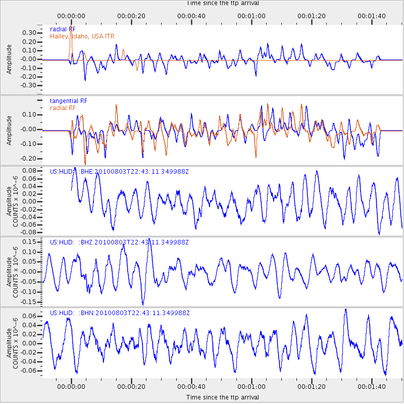
Signal To Noise
| Channel | StoN | STA | LTA |
| US:HLID: :BHZ:20100803T22:43:11.349988Z | 1.0043736 | 4.98557E-8 | 4.96386E-8 |
| US:HLID: :BHN:20100803T22:43:11.349988Z | 1.5323793 | 3.7503533E-8 | 2.4474053E-8 |
| US:HLID: :BHE:20100803T22:43:11.349988Z | 0.34130582 | 1.2505029E-8 | 3.663878E-8 |
| Arrivals |
| Ps | |
| PpPs | |
| PsPs/PpSs | |


