You are here: Home > Network List > US - United States National Seismic Network Stations List
> Station CBKS Cedar Bluff, Kansas, USA > Earthquake Result Viewer
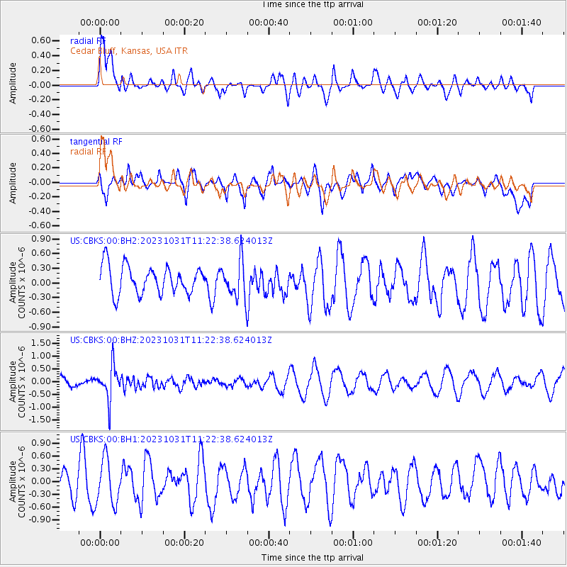
CBKS Cedar Bluff, Kansas, USA - Earthquake Result Viewer
*The percent match for this event was below the threshold and hence no stack was calculated.
| Earthquake location: |
Fiji Islands Region |
| Earthquake latitude/longitude: |
-17.5/-179.0 |
| Earthquake time(UTC): |
2023/10/31 (304) 11:10:56 GMT |
| Earthquake Depth: |
548 km |
| Earthquake Magnitude: |
6.4 mww |
| Earthquake Catalog/Contributor: |
NEIC PDE/us |
|
| Network: |
US United States National Seismic Network |
| Station: |
CBKS Cedar Bluff, Kansas, USA |
| Lat/Lon: |
38.81 N/99.74 W |
| Elevation: |
677 m |
|
| Distance: |
92.8 deg |
| Az: |
50.218 deg |
| Baz: |
249.805 deg |
| Ray Param: |
$rayparam |
*The percent match for this event was below the threshold and hence was not used in the summary stack. |
|
| Radial Match: |
75.438034 % |
| Radial Bump: |
400 |
| Transverse Match: |
44.73369 % |
| Transverse Bump: |
400 |
| SOD ConfigId: |
31937991 |
| Insert Time: |
2023-11-14 11:43:25.958 +0000 |
| GWidth: |
2.5 |
| Max Bumps: |
400 |
| Tol: |
0.001 |
|
Signal To Noise
| Channel | StoN | STA | LTA |
| US:CBKS:00:BHZ:20231031T11:22:38.624013Z | 2.7078035 | 6.6875873E-7 | 2.4697462E-7 |
| US:CBKS:00:BH1:20231031T11:22:38.624013Z | 1.5760794 | 5.3278967E-7 | 3.3804747E-7 |
| US:CBKS:00:BH2:20231031T11:22:38.624013Z | 1.3959831 | 3.965472E-7 | 2.8406305E-7 |
| Arrivals |
| Ps | |
| PpPs | |
| PsPs/PpSs | |


