You are here: Home > Network List > US - United States National Seismic Network Stations List
> Station MSO Missoula, Montana, USA > Earthquake Result Viewer
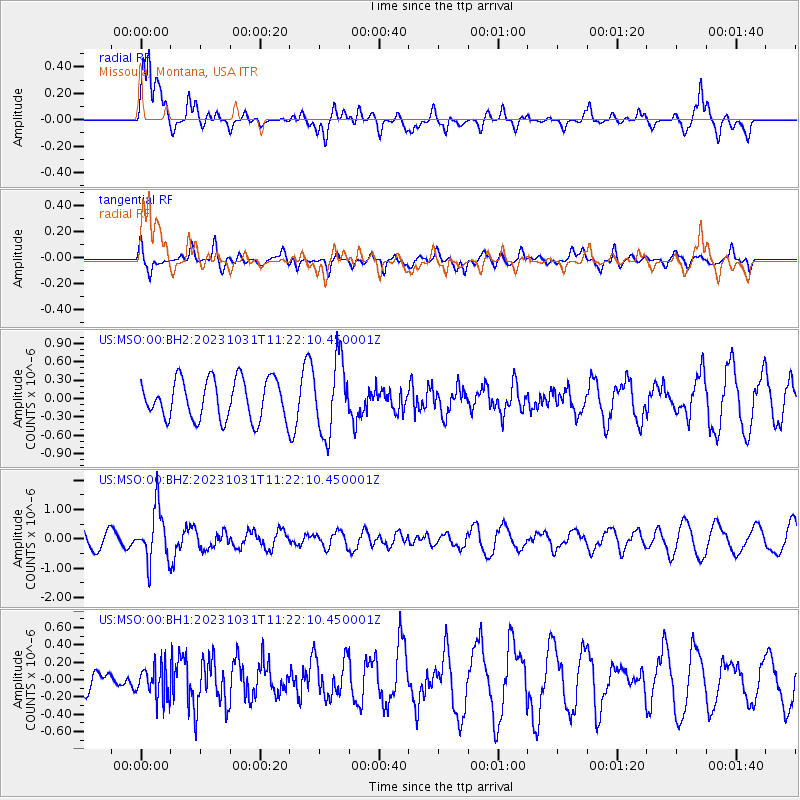
MSO Missoula, Montana, USA - Earthquake Result Viewer
*The percent match for this event was below the threshold and hence no stack was calculated.
| Earthquake location: |
Fiji Islands Region |
| Earthquake latitude/longitude: |
-17.5/-179.0 |
| Earthquake time(UTC): |
2023/10/31 (304) 11:10:56 GMT |
| Earthquake Depth: |
548 km |
| Earthquake Magnitude: |
6.4 mww |
| Earthquake Catalog/Contributor: |
NEIC PDE/us |
|
| Network: |
US United States National Seismic Network |
| Station: |
MSO Missoula, Montana, USA |
| Lat/Lon: |
46.83 N/113.94 W |
| Elevation: |
1264 m |
|
| Distance: |
86.7 deg |
| Az: |
38.588 deg |
| Baz: |
240.075 deg |
| Ray Param: |
$rayparam |
*The percent match for this event was below the threshold and hence was not used in the summary stack. |
|
| Radial Match: |
75.41872 % |
| Radial Bump: |
400 |
| Transverse Match: |
50.690277 % |
| Transverse Bump: |
400 |
| SOD ConfigId: |
31937991 |
| Insert Time: |
2023-11-14 11:43:48.675 +0000 |
| GWidth: |
2.5 |
| Max Bumps: |
400 |
| Tol: |
0.001 |
|
Signal To Noise
| Channel | StoN | STA | LTA |
| US:MSO:00:BHZ:20231031T11:22:10.450001Z | 2.1831965 | 8.789661E-7 | 4.026051E-7 |
| US:MSO:00:BH1:20231031T11:22:10.450001Z | 0.69950044 | 1.8637617E-7 | 2.6644182E-7 |
| US:MSO:00:BH2:20231031T11:22:10.450001Z | 1.8270226 | 5.923599E-7 | 3.2422147E-7 |
| Arrivals |
| Ps | |
| PpPs | |
| PsPs/PpSs | |


