You are here: Home > Network List > CI - Caltech Regional Seismic Network Stations List
> Station DAN Danby, California, USA > Earthquake Result Viewer
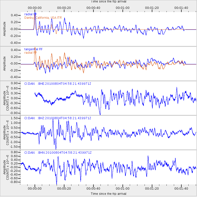
DAN Danby, California, USA - Earthquake Result Viewer
*The percent match for this event was below the threshold and hence no stack was calculated.
| Earthquake location: |
South Of Fiji Islands |
| Earthquake latitude/longitude: |
-26.9/-177.2 |
| Earthquake time(UTC): |
2010/08/04 (216) 04:46:20 GMT |
| Earthquake Depth: |
18 km |
| Earthquake Magnitude: |
5.7 MB, 5.8 MS, 6.0 MW, 5.9 MW |
| Earthquake Catalog/Contributor: |
WHDF/NEIC |
|
| Network: |
CI Caltech Regional Seismic Network |
| Station: |
DAN Danby, California, USA |
| Lat/Lon: |
34.64 N/115.38 W |
| Elevation: |
398 m |
|
| Distance: |
84.7 deg |
| Az: |
46.906 deg |
| Baz: |
232.257 deg |
| Ray Param: |
$rayparam |
*The percent match for this event was below the threshold and hence was not used in the summary stack. |
|
| Radial Match: |
75.86588 % |
| Radial Bump: |
400 |
| Transverse Match: |
58.67175 % |
| Transverse Bump: |
400 |
| SOD ConfigId: |
319893 |
| Insert Time: |
2011-01-05 15:39:51.862 +0000 |
| GWidth: |
2.5 |
| Max Bumps: |
400 |
| Tol: |
0.001 |
|
Signal To Noise
| Channel | StoN | STA | LTA |
| CI:DAN: :BHZ:20100804T04:58:21.439971Z | 5.146279 | 3.7229483E-7 | 7.234253E-8 |
| CI:DAN: :BHN:20100804T04:58:21.439971Z | 1.1909816 | 1.2946914E-7 | 1.0870793E-7 |
| CI:DAN: :BHE:20100804T04:58:21.439971Z | 1.1030898 | 1.8950047E-7 | 1.717906E-7 |
| Arrivals |
| Ps | |
| PpPs | |
| PsPs/PpSs | |


