You are here: Home > Network List > TA - USArray Transportable Network (new EarthScope stations) Stations List
> Station H21A Big Horn, Sheridan, WY, USA > Earthquake Result Viewer
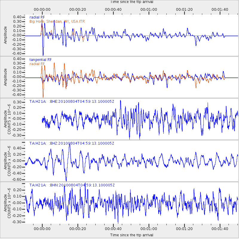
H21A Big Horn, Sheridan, WY, USA - Earthquake Result Viewer
*The percent match for this event was below the threshold and hence no stack was calculated.
| Earthquake location: |
South Of Fiji Islands |
| Earthquake latitude/longitude: |
-26.9/-177.2 |
| Earthquake time(UTC): |
2010/08/04 (216) 04:46:20 GMT |
| Earthquake Depth: |
18 km |
| Earthquake Magnitude: |
5.7 MB, 5.8 MS, 6.0 MW, 5.9 MW |
| Earthquake Catalog/Contributor: |
WHDF/NEIC |
|
| Network: |
TA USArray Transportable Network (new EarthScope stations) |
| Station: |
H21A Big Horn, Sheridan, WY, USA |
| Lat/Lon: |
44.63 N/107.04 W |
| Elevation: |
1411 m |
|
| Distance: |
95.7 deg |
| Az: |
42.467 deg |
| Baz: |
237.596 deg |
| Ray Param: |
$rayparam |
*The percent match for this event was below the threshold and hence was not used in the summary stack. |
|
| Radial Match: |
65.053795 % |
| Radial Bump: |
400 |
| Transverse Match: |
51.80833 % |
| Transverse Bump: |
400 |
| SOD ConfigId: |
319893 |
| Insert Time: |
2011-01-05 15:45:10.009 +0000 |
| GWidth: |
2.5 |
| Max Bumps: |
400 |
| Tol: |
0.001 |
|
Signal To Noise
| Channel | StoN | STA | LTA |
| TA:H21A: :BHZ:20100804T04:59:13.100005Z | 2.755583 | 1.6537753E-7 | 6.001544E-8 |
| TA:H21A: :BHN:20100804T04:59:13.100005Z | 0.54524606 | 4.4407123E-8 | 8.144419E-8 |
| TA:H21A: :BHE:20100804T04:59:13.100005Z | 0.94766456 | 7.6829735E-8 | 8.107271E-8 |
| Arrivals |
| Ps | |
| PpPs | |
| PsPs/PpSs | |


