You are here: Home > Network List > GM - US Geological Survey Networks Stations List
> Station IWM01 Jericho 2M Well Monitoring Station > Earthquake Result Viewer
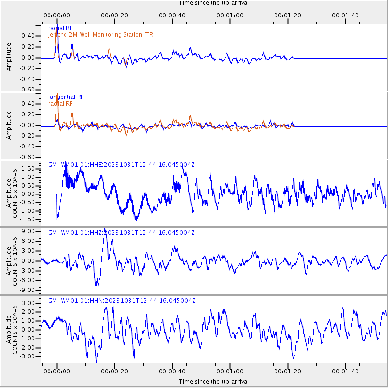
IWM01 Jericho 2M Well Monitoring Station - Earthquake Result Viewer
*The percent match for this event was below the threshold and hence no stack was calculated.
| Earthquake location: |
Near Coast Of Central Chile |
| Earthquake latitude/longitude: |
-28.7/-71.6 |
| Earthquake time(UTC): |
2023/10/31 (304) 12:33:44 GMT |
| Earthquake Depth: |
41 km |
| Earthquake Magnitude: |
6.7 mww |
| Earthquake Catalog/Contributor: |
NEIC PDE/us |
|
| Network: |
GM US Geological Survey Networks |
| Station: |
IWM01 Jericho 2M Well Monitoring Station |
| Lat/Lon: |
36.73 N/96.53 W |
| Elevation: |
328 m |
|
| Distance: |
69.2 deg |
| Az: |
338.74 deg |
| Baz: |
156.652 deg |
| Ray Param: |
$rayparam |
*The percent match for this event was below the threshold and hence was not used in the summary stack. |
|
| Radial Match: |
51.011852 % |
| Radial Bump: |
384 |
| Transverse Match: |
26.517853 % |
| Transverse Bump: |
400 |
| SOD ConfigId: |
31937991 |
| Insert Time: |
2023-11-14 12:44:46.918 +0000 |
| GWidth: |
2.5 |
| Max Bumps: |
400 |
| Tol: |
0.001 |
|
Signal To Noise
| Channel | StoN | STA | LTA |
| GM:IWM01:01:HHZ:20231031T12:44:16.045004Z | 1.9559592 | 9.960231E-7 | 5.0922483E-7 |
| GM:IWM01:01:HHN:20231031T12:44:16.045004Z | 0.4248621 | 6.3023646E-7 | 1.4833906E-6 |
| GM:IWM01:01:HHE:20231031T12:44:16.045004Z | 1.3172868 | 9.820305E-7 | 7.454948E-7 |
| Arrivals |
| Ps | |
| PpPs | |
| PsPs/PpSs | |


