You are here: Home > Network List > IW - Intermountain West Stations List
> Station MOOW Moose Ponds, Wyoming, USA > Earthquake Result Viewer
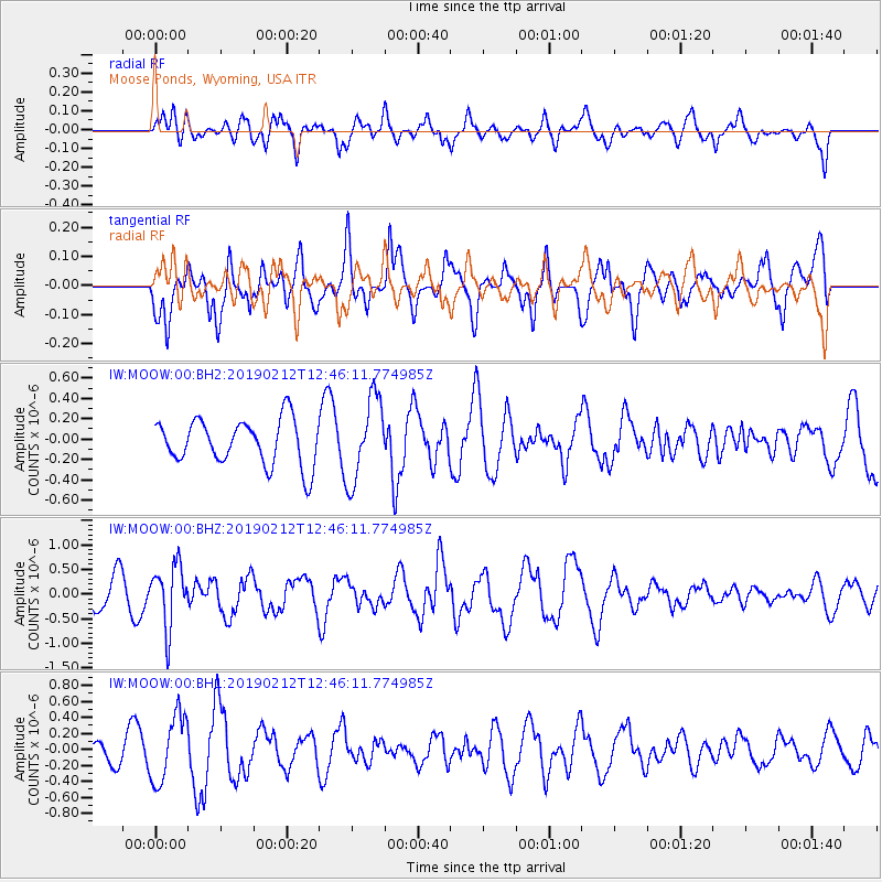
MOOW Moose Ponds, Wyoming, USA - Earthquake Result Viewer
*The percent match for this event was below the threshold and hence no stack was calculated.
| Earthquake location: |
Mariana Islands |
| Earthquake latitude/longitude: |
19.1/145.8 |
| Earthquake time(UTC): |
2019/02/12 (043) 12:34:15 GMT |
| Earthquake Depth: |
130 km |
| Earthquake Magnitude: |
5.9 mww |
| Earthquake Catalog/Contributor: |
NEIC PDE/us |
|
| Network: |
IW Intermountain West |
| Station: |
MOOW Moose Ponds, Wyoming, USA |
| Lat/Lon: |
43.75 N/110.74 W |
| Elevation: |
2128 m |
|
| Distance: |
86.3 deg |
| Az: |
44.924 deg |
| Baz: |
292.839 deg |
| Ray Param: |
$rayparam |
*The percent match for this event was below the threshold and hence was not used in the summary stack. |
|
| Radial Match: |
60.649025 % |
| Radial Bump: |
400 |
| Transverse Match: |
48.87169 % |
| Transverse Bump: |
400 |
| SOD ConfigId: |
3287751 |
| Insert Time: |
2019-02-26 12:55:03.445 +0000 |
| GWidth: |
2.5 |
| Max Bumps: |
400 |
| Tol: |
0.001 |
|
Signal To Noise
| Channel | StoN | STA | LTA |
| IW:MOOW:00:BHZ:20190212T12:46:11.774985Z | 2.095603 | 6.2100094E-7 | 2.9633523E-7 |
| IW:MOOW:00:BH1:20190212T12:46:11.774985Z | 3.452793 | 4.203366E-7 | 1.2173814E-7 |
| IW:MOOW:00:BH2:20190212T12:46:11.774985Z | 1.849556 | 4.1046812E-7 | 2.2192792E-7 |
| Arrivals |
| Ps | |
| PpPs | |
| PsPs/PpSs | |


