You are here: Home > Network List > IW - Intermountain West Stations List
> Station PLID Pearl Lake, Idaho, USA > Earthquake Result Viewer
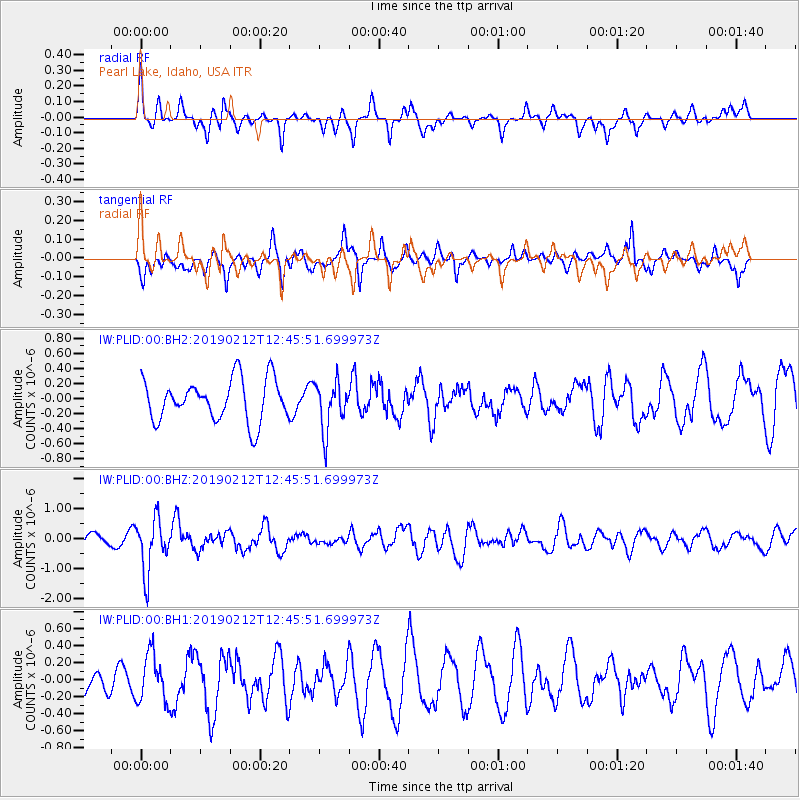
PLID Pearl Lake, Idaho, USA - Earthquake Result Viewer
*The percent match for this event was below the threshold and hence no stack was calculated.
| Earthquake location: |
Mariana Islands |
| Earthquake latitude/longitude: |
19.1/145.8 |
| Earthquake time(UTC): |
2019/02/12 (043) 12:34:15 GMT |
| Earthquake Depth: |
130 km |
| Earthquake Magnitude: |
5.9 mww |
| Earthquake Catalog/Contributor: |
NEIC PDE/us |
|
| Network: |
IW Intermountain West |
| Station: |
PLID Pearl Lake, Idaho, USA |
| Lat/Lon: |
45.09 N/116.00 W |
| Elevation: |
2164 m |
|
| Distance: |
82.3 deg |
| Az: |
45.026 deg |
| Baz: |
289.182 deg |
| Ray Param: |
$rayparam |
*The percent match for this event was below the threshold and hence was not used in the summary stack. |
|
| Radial Match: |
65.82976 % |
| Radial Bump: |
386 |
| Transverse Match: |
45.29553 % |
| Transverse Bump: |
321 |
| SOD ConfigId: |
3287751 |
| Insert Time: |
2019-02-26 12:55:05.195 +0000 |
| GWidth: |
2.5 |
| Max Bumps: |
400 |
| Tol: |
0.001 |
|
Signal To Noise
| Channel | StoN | STA | LTA |
| IW:PLID:00:BHZ:20190212T12:45:51.699973Z | 2.7149858 | 8.8575104E-7 | 3.2624519E-7 |
| IW:PLID:00:BH1:20190212T12:45:51.699973Z | 1.2590294 | 2.8259572E-7 | 2.2445523E-7 |
| IW:PLID:00:BH2:20190212T12:45:51.699973Z | 1.1566983 | 3.2091685E-7 | 2.7744215E-7 |
| Arrivals |
| Ps | |
| PpPs | |
| PsPs/PpSs | |


