You are here: Home > Network List > TA - USArray Transportable Network (new EarthScope stations) Stations List
> Station P29A Atwood, KS, USA > Earthquake Result Viewer
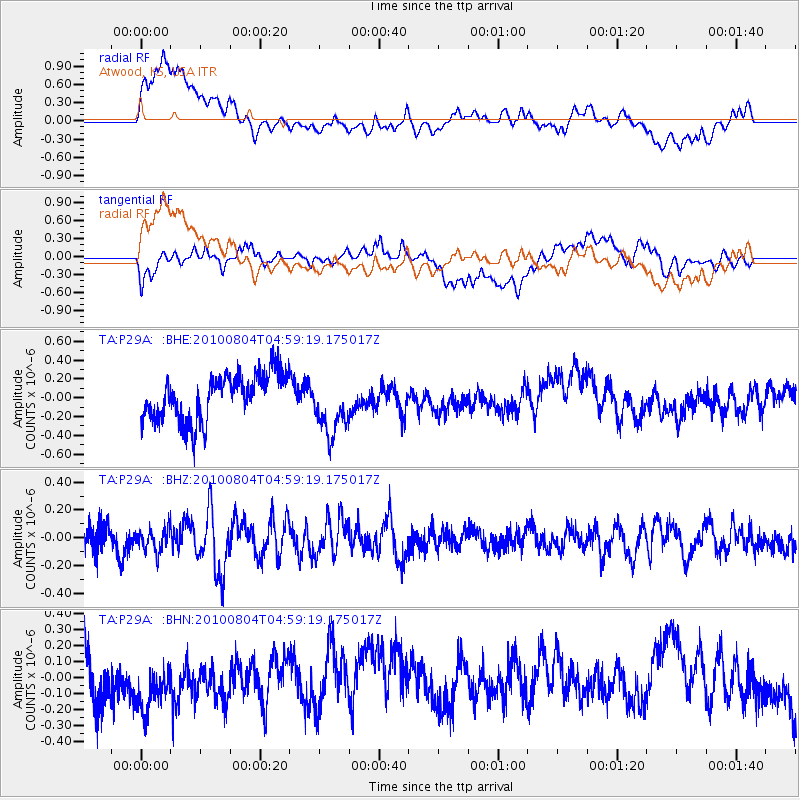
P29A Atwood, KS, USA - Earthquake Result Viewer
*The percent match for this event was below the threshold and hence no stack was calculated.
| Earthquake location: |
South Of Fiji Islands |
| Earthquake latitude/longitude: |
-26.9/-177.2 |
| Earthquake time(UTC): |
2010/08/04 (216) 04:46:20 GMT |
| Earthquake Depth: |
18 km |
| Earthquake Magnitude: |
5.7 MB, 5.8 MS, 6.0 MW, 5.9 MW |
| Earthquake Catalog/Contributor: |
WHDF/NEIC |
|
| Network: |
TA USArray Transportable Network (new EarthScope stations) |
| Station: |
P29A Atwood, KS, USA |
| Lat/Lon: |
39.60 N/100.93 W |
| Elevation: |
929 m |
|
| Distance: |
97.0 deg |
| Az: |
49.144 deg |
| Baz: |
240.943 deg |
| Ray Param: |
$rayparam |
*The percent match for this event was below the threshold and hence was not used in the summary stack. |
|
| Radial Match: |
62.22735 % |
| Radial Bump: |
400 |
| Transverse Match: |
50.479176 % |
| Transverse Bump: |
400 |
| SOD ConfigId: |
319893 |
| Insert Time: |
2011-01-05 15:49:36.829 +0000 |
| GWidth: |
2.5 |
| Max Bumps: |
400 |
| Tol: |
0.001 |
|
Signal To Noise
| Channel | StoN | STA | LTA |
| TA:P29A: :BHZ:20100804T04:59:19.175017Z | 0.83149487 | 8.2272926E-8 | 9.8945804E-8 |
| TA:P29A: :BHN:20100804T04:59:19.175017Z | 1.0878905 | 2.5395778E-7 | 2.3344059E-7 |
| TA:P29A: :BHE:20100804T04:59:19.175017Z | 1.269322 | 3.0901677E-7 | 2.4345024E-7 |
| Arrivals |
| Ps | |
| PpPs | |
| PsPs/PpSs | |


