You are here: Home > Network List > US - United States National Seismic Network Stations List
> Station DGMT Dagmar, Montana, USA > Earthquake Result Viewer
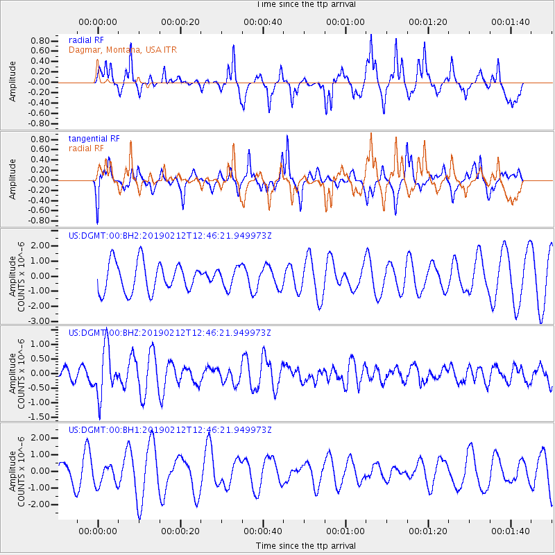
DGMT Dagmar, Montana, USA - Earthquake Result Viewer
*The percent match for this event was below the threshold and hence no stack was calculated.
| Earthquake location: |
Mariana Islands |
| Earthquake latitude/longitude: |
19.1/145.8 |
| Earthquake time(UTC): |
2019/02/12 (043) 12:34:15 GMT |
| Earthquake Depth: |
130 km |
| Earthquake Magnitude: |
5.9 mww |
| Earthquake Catalog/Contributor: |
NEIC PDE/us |
|
| Network: |
US United States National Seismic Network |
| Station: |
DGMT Dagmar, Montana, USA |
| Lat/Lon: |
48.47 N/104.20 W |
| Elevation: |
0.0 m |
|
| Distance: |
88.5 deg |
| Az: |
38.716 deg |
| Baz: |
297.268 deg |
| Ray Param: |
$rayparam |
*The percent match for this event was below the threshold and hence was not used in the summary stack. |
|
| Radial Match: |
76.88425 % |
| Radial Bump: |
380 |
| Transverse Match: |
52.034412 % |
| Transverse Bump: |
314 |
| SOD ConfigId: |
3287751 |
| Insert Time: |
2019-02-26 12:56:36.039 +0000 |
| GWidth: |
2.5 |
| Max Bumps: |
400 |
| Tol: |
0.001 |
|
Signal To Noise
| Channel | StoN | STA | LTA |
| US:DGMT:00:BHZ:20190212T12:46:21.949973Z | 2.004309 | 8.322264E-7 | 4.1521864E-7 |
| US:DGMT:00:BH1:20190212T12:46:21.949973Z | 0.705856 | 6.1241377E-7 | 8.676185E-7 |
| US:DGMT:00:BH2:20190212T12:46:21.949973Z | 0.7004865 | 6.831247E-7 | 9.752147E-7 |
| Arrivals |
| Ps | |
| PpPs | |
| PsPs/PpSs | |


