You are here: Home > Network List > US - United States National Seismic Network Stations List
> Station BOZ Bozeman, Montana, USA > Earthquake Result Viewer
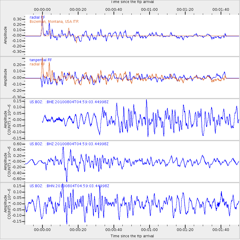
BOZ Bozeman, Montana, USA - Earthquake Result Viewer
*The percent match for this event was below the threshold and hence no stack was calculated.
| Earthquake location: |
South Of Fiji Islands |
| Earthquake latitude/longitude: |
-26.9/-177.2 |
| Earthquake time(UTC): |
2010/08/04 (216) 04:46:20 GMT |
| Earthquake Depth: |
18 km |
| Earthquake Magnitude: |
5.7 MB, 5.8 MS, 6.0 MW, 5.9 MW |
| Earthquake Catalog/Contributor: |
WHDF/NEIC |
|
| Network: |
US United States National Seismic Network |
| Station: |
BOZ Bozeman, Montana, USA |
| Lat/Lon: |
45.65 N/111.63 W |
| Elevation: |
1589 m |
|
| Distance: |
93.6 deg |
| Az: |
39.802 deg |
| Baz: |
234.569 deg |
| Ray Param: |
$rayparam |
*The percent match for this event was below the threshold and hence was not used in the summary stack. |
|
| Radial Match: |
70.23368 % |
| Radial Bump: |
400 |
| Transverse Match: |
52.505478 % |
| Transverse Bump: |
400 |
| SOD ConfigId: |
319893 |
| Insert Time: |
2011-01-05 15:53:06.054 +0000 |
| GWidth: |
2.5 |
| Max Bumps: |
400 |
| Tol: |
0.001 |
|
Signal To Noise
| Channel | StoN | STA | LTA |
| US:BOZ: :BHZ:20100804T04:59:03.44998Z | 2.2837617 | 8.779912E-8 | 3.844496E-8 |
| US:BOZ: :BHN:20100804T04:59:03.44998Z | 1.8556134 | 6.7119835E-8 | 3.617124E-8 |
| US:BOZ: :BHE:20100804T04:59:03.44998Z | 2.6901534 | 6.326437E-8 | 2.3517014E-8 |
| Arrivals |
| Ps | |
| PpPs | |
| PsPs/PpSs | |


