You are here: Home > Network List > US - United States National Seismic Network Stations List
> Station HAWA Hanford, Washington, USA > Earthquake Result Viewer
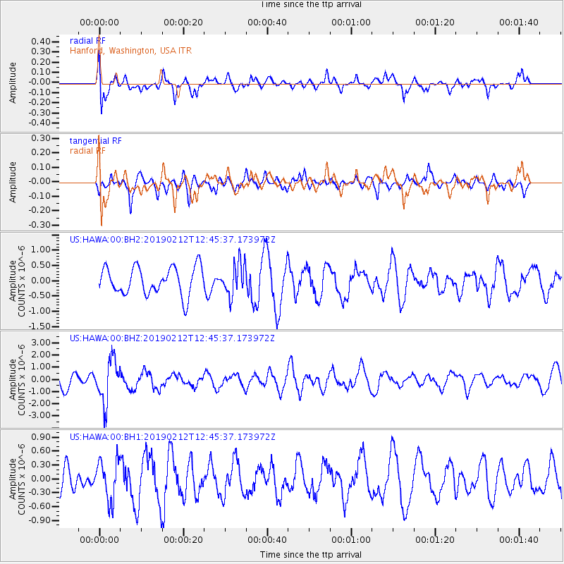
HAWA Hanford, Washington, USA - Earthquake Result Viewer
*The percent match for this event was below the threshold and hence no stack was calculated.
| Earthquake location: |
Mariana Islands |
| Earthquake latitude/longitude: |
19.1/145.8 |
| Earthquake time(UTC): |
2019/02/12 (043) 12:34:15 GMT |
| Earthquake Depth: |
130 km |
| Earthquake Magnitude: |
5.9 mww |
| Earthquake Catalog/Contributor: |
NEIC PDE/us |
|
| Network: |
US United States National Seismic Network |
| Station: |
HAWA Hanford, Washington, USA |
| Lat/Lon: |
46.39 N/119.53 W |
| Elevation: |
364 m |
|
| Distance: |
79.6 deg |
| Az: |
44.538 deg |
| Baz: |
286.583 deg |
| Ray Param: |
$rayparam |
*The percent match for this event was below the threshold and hence was not used in the summary stack. |
|
| Radial Match: |
64.60447 % |
| Radial Bump: |
400 |
| Transverse Match: |
63.72749 % |
| Transverse Bump: |
395 |
| SOD ConfigId: |
3287751 |
| Insert Time: |
2019-02-26 12:56:44.788 +0000 |
| GWidth: |
2.5 |
| Max Bumps: |
400 |
| Tol: |
0.001 |
|
Signal To Noise
| Channel | StoN | STA | LTA |
| US:HAWA:00:BHZ:20190212T12:45:37.173972Z | 3.6986086 | 1.797928E-6 | 4.861093E-7 |
| US:HAWA:00:BH1:20190212T12:45:37.173972Z | 1.6267807 | 4.4083816E-7 | 2.7098807E-7 |
| US:HAWA:00:BH2:20190212T12:45:37.173972Z | 1.1785898 | 5.311672E-7 | 4.5068026E-7 |
| Arrivals |
| Ps | |
| PpPs | |
| PsPs/PpSs | |


