You are here: Home > Network List > US - United States National Seismic Network Stations List
> Station RLMT Red Lodge, Montana, USA > Earthquake Result Viewer
RLMT Red Lodge, Montana, USA - Earthquake Result Viewer

| Earthquake location: |
Near Coast Of Central Chile |
| Earthquake latitude/longitude: |
-28.7/-71.6 |
| Earthquake time(UTC): |
2023/10/31 (304) 12:33:44 GMT |
| Earthquake Depth: |
41 km |
| Earthquake Magnitude: |
6.7 mww |
| Earthquake Catalog/Contributor: |
NEIC PDE/us |
|
| Network: |
US United States National Seismic Network |
| Station: |
RLMT Red Lodge, Montana, USA |
| Lat/Lon: |
45.12 N/109.27 W |
| Elevation: |
2086 m |
|
| Distance: |
81.1 deg |
| Az: |
334.016 deg |
| Baz: |
147.084 deg |
| Ray Param: |
0.04773749 |
| Estimated Moho Depth: |
10.0 km |
| Estimated Crust Vp/Vs: |
1.60 |
| Assumed Crust Vp: |
6.242 km/s |
| Estimated Crust Vs: |
3.901 km/s |
| Estimated Crust Poisson's Ratio: |
0.18 |
|
| Radial Match: |
90.999 % |
| Radial Bump: |
400 |
| Transverse Match: |
65.469215 % |
| Transverse Bump: |
400 |
| SOD ConfigId: |
31937991 |
| Insert Time: |
2023-11-14 13:02:21.988 +0000 |
| GWidth: |
2.5 |
| Max Bumps: |
400 |
| Tol: |
0.001 |
|
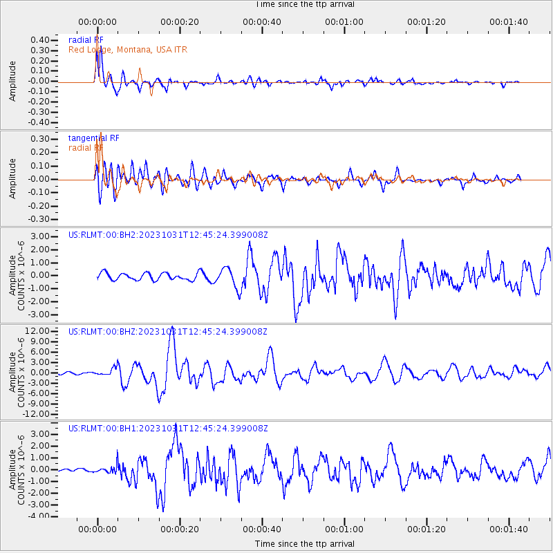
Signal To Noise
| Channel | StoN | STA | LTA |
| US:RLMT:00:BHZ:20231031T12:45:24.399008Z | 2.857152 | 1.0844261E-6 | 3.7954794E-7 |
| US:RLMT:00:BH1:20231031T12:45:24.399008Z | 0.9661713 | 3.6273812E-7 | 3.754387E-7 |
| US:RLMT:00:BH2:20231031T12:45:24.399008Z | 3.026508 | 8.043459E-7 | 2.65767E-7 |
| Arrivals |
| Ps | 1.0 SECOND |
| PpPs | 4.0 SECOND |
| PsPs/PpSs | 5.0 SECOND |


