You are here: Home > Network List > US - United States National Seismic Network Stations List
> Station WMOK Wichita Mountains, Oklahoma, USA > Earthquake Result Viewer
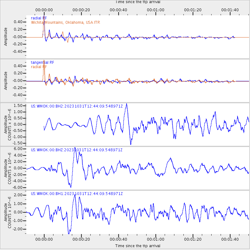
WMOK Wichita Mountains, Oklahoma, USA - Earthquake Result Viewer
*The percent match for this event was below the threshold and hence no stack was calculated.
| Earthquake location: |
Near Coast Of Central Chile |
| Earthquake latitude/longitude: |
-28.7/-71.6 |
| Earthquake time(UTC): |
2023/10/31 (304) 12:33:44 GMT |
| Earthquake Depth: |
41 km |
| Earthquake Magnitude: |
6.7 mww |
| Earthquake Catalog/Contributor: |
NEIC PDE/us |
|
| Network: |
US United States National Seismic Network |
| Station: |
WMOK Wichita Mountains, Oklahoma, USA |
| Lat/Lon: |
34.74 N/98.78 W |
| Elevation: |
486 m |
|
| Distance: |
68.2 deg |
| Az: |
336.07 deg |
| Baz: |
154.374 deg |
| Ray Param: |
$rayparam |
*The percent match for this event was below the threshold and hence was not used in the summary stack. |
|
| Radial Match: |
77.7846 % |
| Radial Bump: |
400 |
| Transverse Match: |
61.760044 % |
| Transverse Bump: |
400 |
| SOD ConfigId: |
31937991 |
| Insert Time: |
2023-11-14 13:02:27.902 +0000 |
| GWidth: |
2.5 |
| Max Bumps: |
400 |
| Tol: |
0.001 |
|
Signal To Noise
| Channel | StoN | STA | LTA |
| US:WMOK:00:BHZ:20231031T12:44:09.548971Z | 1.6976662 | 4.4333774E-7 | 2.611454E-7 |
| US:WMOK:00:BH1:20231031T12:44:09.548971Z | 3.6602566 | 6.3640175E-7 | 1.7386807E-7 |
| US:WMOK:00:BH2:20231031T12:44:09.548971Z | 2.3485804 | 5.0915725E-7 | 2.1679364E-7 |
| Arrivals |
| Ps | |
| PpPs | |
| PsPs/PpSs | |


