You are here: Home > Network List > UW - Pacific Northwest Regional Seismic Network Stations List
> Station HOOD Mt Hood Meadows, OR CREST BB SMO > Earthquake Result Viewer
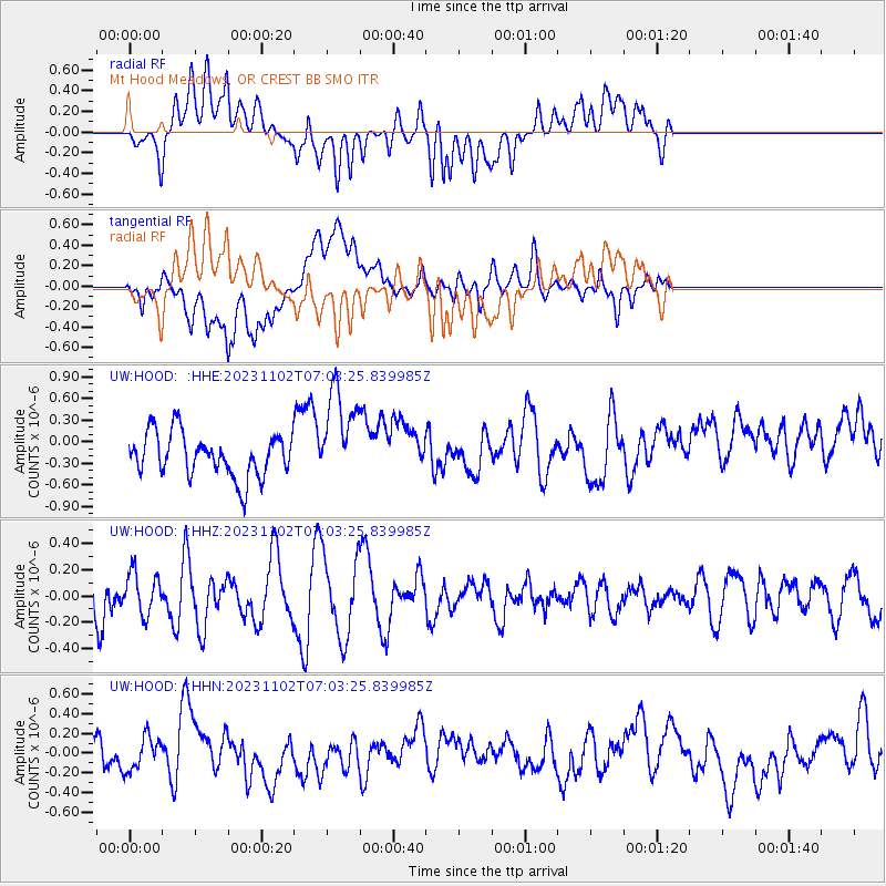
HOOD Mt Hood Meadows, OR CREST BB SMO - Earthquake Result Viewer
*The percent match for this event was below the threshold and hence no stack was calculated.
| Earthquake location: |
Samar, Philippines |
| Earthquake latitude/longitude: |
11.5/125.9 |
| Earthquake time(UTC): |
2023/11/02 (306) 06:50:26 GMT |
| Earthquake Depth: |
19 km |
| Earthquake Magnitude: |
5.7 Mww |
| Earthquake Catalog/Contributor: |
NEIC PDE/us |
|
| Network: |
UW Pacific Northwest Regional Seismic Network |
| Station: |
HOOD Mt Hood Meadows, OR CREST BB SMO |
| Lat/Lon: |
45.32 N/121.65 W |
| Elevation: |
1520 m |
|
| Distance: |
97.1 deg |
| Az: |
41.089 deg |
| Baz: |
294.047 deg |
| Ray Param: |
$rayparam |
*The percent match for this event was below the threshold and hence was not used in the summary stack. |
|
| Radial Match: |
46.61622 % |
| Radial Bump: |
400 |
| Transverse Match: |
52.814213 % |
| Transverse Bump: |
400 |
| SOD ConfigId: |
31937991 |
| Insert Time: |
2023-11-16 07:05:19.301 +0000 |
| GWidth: |
2.5 |
| Max Bumps: |
400 |
| Tol: |
0.001 |
|
Signal To Noise
| Channel | StoN | STA | LTA |
| UW:HOOD: :HHZ:20231102T07:03:25.839985Z | 0.88502663 | 1.553346E-7 | 1.7551403E-7 |
| UW:HOOD: :HHN:20231102T07:03:25.839985Z | 0.8074225 | 1.6904761E-7 | 2.0936697E-7 |
| UW:HOOD: :HHE:20231102T07:03:25.839985Z | 2.190477 | 6.521917E-7 | 2.977396E-7 |
| Arrivals |
| Ps | |
| PpPs | |
| PsPs/PpSs | |


