You are here: Home > Network List > TA - USArray Transportable Network (new EarthScope stations) Stations List
> Station J04D Umpqua National Forest, Toketee, OR, USA > Earthquake Result Viewer
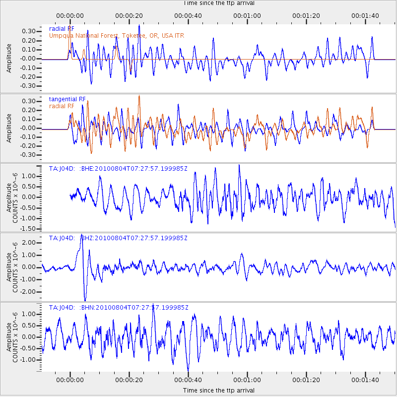
J04D Umpqua National Forest, Toketee, OR, USA - Earthquake Result Viewer
*The percent match for this event was below the threshold and hence no stack was calculated.
| Earthquake location: |
Eastern New Guinea Reg., P.N.G. |
| Earthquake latitude/longitude: |
-5.5/146.8 |
| Earthquake time(UTC): |
2010/08/04 (216) 07:15:34 GMT |
| Earthquake Depth: |
226 km |
| Earthquake Magnitude: |
6.1 MB, 6.5 MW, 6.4 MW |
| Earthquake Catalog/Contributor: |
WHDF/NEIC |
|
| Network: |
TA USArray Transportable Network (new EarthScope stations) |
| Station: |
J04D Umpqua National Forest, Toketee, OR, USA |
| Lat/Lon: |
43.24 N/122.11 W |
| Elevation: |
1948 m |
|
| Distance: |
94.5 deg |
| Az: |
47.132 deg |
| Baz: |
266.738 deg |
| Ray Param: |
$rayparam |
*The percent match for this event was below the threshold and hence was not used in the summary stack. |
|
| Radial Match: |
63.947807 % |
| Radial Bump: |
400 |
| Transverse Match: |
75.61761 % |
| Transverse Bump: |
400 |
| SOD ConfigId: |
319893 |
| Insert Time: |
2011-01-05 16:14:13.206 +0000 |
| GWidth: |
2.5 |
| Max Bumps: |
400 |
| Tol: |
0.001 |
|
Signal To Noise
| Channel | StoN | STA | LTA |
| TA:J04D: :BHZ:20100804T07:27:57.199985Z | 5.5461783 | 1.2161189E-6 | 2.192715E-7 |
| TA:J04D: :BHN:20100804T07:27:57.199985Z | 1.0161337 | 3.0186118E-7 | 2.9706834E-7 |
| TA:J04D: :BHE:20100804T07:27:57.199985Z | 0.7851133 | 3.396539E-7 | 4.326177E-7 |
| Arrivals |
| Ps | |
| PpPs | |
| PsPs/PpSs | |


