You are here: Home > Network List > TA - USArray Transportable Network (new EarthScope stations) Stations List
> Station I03D Drain, OR, USA > Earthquake Result Viewer
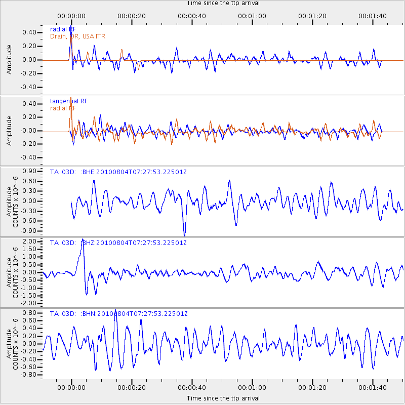
I03D Drain, OR, USA - Earthquake Result Viewer
*The percent match for this event was below the threshold and hence no stack was calculated.
| Earthquake location: |
Eastern New Guinea Reg., P.N.G. |
| Earthquake latitude/longitude: |
-5.5/146.8 |
| Earthquake time(UTC): |
2010/08/04 (216) 07:15:34 GMT |
| Earthquake Depth: |
226 km |
| Earthquake Magnitude: |
6.1 MB, 6.5 MW, 6.4 MW |
| Earthquake Catalog/Contributor: |
WHDF/NEIC |
|
| Network: |
TA USArray Transportable Network (new EarthScope stations) |
| Station: |
I03D Drain, OR, USA |
| Lat/Lon: |
43.70 N/123.35 W |
| Elevation: |
140 m |
|
| Distance: |
93.6 deg |
| Az: |
46.617 deg |
| Baz: |
265.925 deg |
| Ray Param: |
$rayparam |
*The percent match for this event was below the threshold and hence was not used in the summary stack. |
|
| Radial Match: |
69.20863 % |
| Radial Bump: |
400 |
| Transverse Match: |
48.233253 % |
| Transverse Bump: |
333 |
| SOD ConfigId: |
319893 |
| Insert Time: |
2011-01-05 16:14:55.349 +0000 |
| GWidth: |
2.5 |
| Max Bumps: |
400 |
| Tol: |
0.001 |
|
Signal To Noise
| Channel | StoN | STA | LTA |
| TA:I03D: :BHZ:20100804T07:27:53.22501Z | 7.1875196 | 9.998724E-7 | 1.391123E-7 |
| TA:I03D: :BHN:20100804T07:27:53.22501Z | 1.4061499 | 2.1942965E-7 | 1.5604998E-7 |
| TA:I03D: :BHE:20100804T07:27:53.22501Z | 1.1185079 | 2.5136742E-7 | 2.2473459E-7 |
| Arrivals |
| Ps | |
| PpPs | |
| PsPs/PpSs | |


