You are here: Home > Network List > GS - US Geological Survey Networks Stations List
> Station KAN13 Rinehart Farm > Earthquake Result Viewer
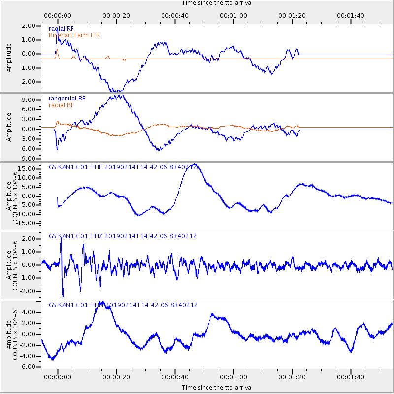
KAN13 Rinehart Farm - Earthquake Result Viewer
*The percent match for this event was below the threshold and hence no stack was calculated.
| Earthquake location: |
Central Peru |
| Earthquake latitude/longitude: |
-12.2/-74.3 |
| Earthquake time(UTC): |
2019/02/14 (045) 14:33:16 GMT |
| Earthquake Depth: |
10 km |
| Earthquake Magnitude: |
5.4 Mww |
| Earthquake Catalog/Contributor: |
NEIC PDE/us |
|
| Network: |
GS US Geological Survey Networks |
| Station: |
KAN13 Rinehart Farm |
| Lat/Lon: |
37.01 N/97.48 W |
| Elevation: |
340 m |
|
| Distance: |
53.6 deg |
| Az: |
336.977 deg |
| Baz: |
151.462 deg |
| Ray Param: |
$rayparam |
*The percent match for this event was below the threshold and hence was not used in the summary stack. |
|
| Radial Match: |
44.429634 % |
| Radial Bump: |
400 |
| Transverse Match: |
41.909622 % |
| Transverse Bump: |
400 |
| SOD ConfigId: |
3287751 |
| Insert Time: |
2019-02-28 14:53:34.335 +0000 |
| GWidth: |
2.5 |
| Max Bumps: |
400 |
| Tol: |
0.001 |
|
Signal To Noise
| Channel | StoN | STA | LTA |
| GS:KAN13:01:HHZ:20190214T14:42:06.834021Z | 4.8386345 | 9.3686305E-7 | 1.9362137E-7 |
| GS:KAN13:01:HHN:20190214T14:42:06.834021Z | 3.3165655 | 2.9864602E-6 | 9.004677E-7 |
| GS:KAN13:01:HHE:20190214T14:42:06.834021Z | 2.937473 | 8.211786E-6 | 2.7955273E-6 |
| Arrivals |
| Ps | |
| PpPs | |
| PsPs/PpSs | |


