BZN AZ.BZN - Earthquake Result Viewer
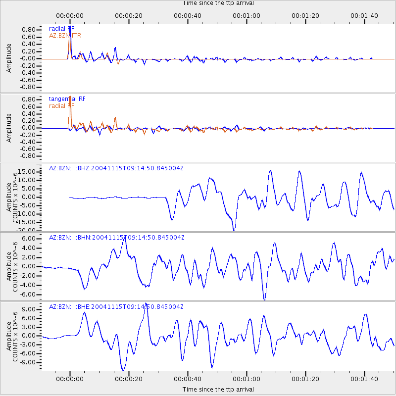
Earthquake location: Near West Coast Of Colombia
Earthquake latitude/longitude: 4.7/-77.5
Earthquake time(UTC): 2004/11/15 (320) 09:06:56 GMT
Earthquake Depth: 15 km
Earthquake Magnitude: 6.6 MB, 7.1 MS, 7.2 MW, 7.1 MW
Earthquake Catalog/Contributor: WHDF/NEIC
Network: AZ ANZA Regional Network
Station: BZN AZ.BZN
Lat/Lon: 33.49 N/116.67 W
Elevation: 1301 m
Distance: 46.3 deg
Az: 313.153 deg
Baz: 119.53 deg
Ray Param: 0.07069765
Estimated Moho Depth: 26.75 km
Estimated Crust Vp/Vs: 1.72
Assumed Crust Vp: 6.264 km/s
Estimated Crust Vs: 3.636 km/s
Estimated Crust Poisson's Ratio: 0.25
Radial Match: 94.92747 %
Radial Bump: 385
Transverse Match: 86.437065 %
Transverse Bump: 400
SOD ConfigId: 2459
Insert Time: 2010-02-26 18:40:06.978 +0000
GWidth: 2.5
Max Bumps: 400
Tol: 0.001

Signal To Noise

ChannelStoNSTALTA
AZ:BZN: :BHN:20041115T09:14:50.845004Z11.0216991.7483558E-61.5862852E-7
AZ:BZN: :BHE:20041115T09:14:50.845004Z5.87409973.142382E-65.3495546E-7
AZ:BZN: :BHZ:20041115T09:14:50.845004Z17.2079325.2672294E-63.060931E-7
Arrivals
Ps3.3 SECOND
PpPs11 SECOND
PsPs/PpSs14 SECOND