You are here: Home > Network List > IC - New China Digital Seismograph Network Stations List
> Station LSA Tibet, China > Earthquake Result Viewer
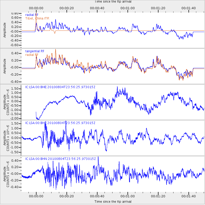
LSA Tibet, China - Earthquake Result Viewer
*The percent match for this event was below the threshold and hence no stack was calculated.
| Earthquake location: |
East Of Kuril Islands |
| Earthquake latitude/longitude: |
46.0/153.2 |
| Earthquake time(UTC): |
2010/08/04 (216) 23:48:02 GMT |
| Earthquake Depth: |
28 km |
| Earthquake Magnitude: |
5.6 MB, 5.5 MS |
| Earthquake Catalog/Contributor: |
WHDF/NEIC |
|
| Network: |
IC New China Digital Seismograph Network |
| Station: |
LSA Tibet, China |
| Lat/Lon: |
29.70 N/91.15 E |
| Elevation: |
3789 m |
|
| Distance: |
50.4 deg |
| Az: |
273.813 deg |
| Baz: |
53.1 deg |
| Ray Param: |
$rayparam |
*The percent match for this event was below the threshold and hence was not used in the summary stack. |
|
| Radial Match: |
42.430923 % |
| Radial Bump: |
400 |
| Transverse Match: |
49.861996 % |
| Transverse Bump: |
400 |
| SOD ConfigId: |
319893 |
| Insert Time: |
2011-01-05 17:31:53.637 +0000 |
| GWidth: |
2.5 |
| Max Bumps: |
400 |
| Tol: |
0.001 |
|
Signal To Noise
| Channel | StoN | STA | LTA |
| IC:LSA:00:BHZ:20100804T23:56:25.973015Z | 3.902409 | 2.9430652E-7 | 7.541662E-8 |
| IC:LSA:00:BHN:20100804T23:56:25.973015Z | 1.9404675 | 1.12217535E-7 | 5.7830157E-8 |
| IC:LSA:00:BHE:20100804T23:56:25.973015Z | 0.3180898 | 2.6540872E-7 | 8.3438294E-7 |
| Arrivals |
| Ps | |
| PpPs | |
| PsPs/PpSs | |


