You are here: Home > Network List > IW - Intermountain West Stations List
> Station MOOW Moose Ponds, Wyoming, USA > Earthquake Result Viewer
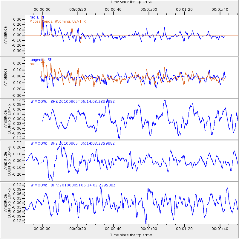
MOOW Moose Ponds, Wyoming, USA - Earthquake Result Viewer
*The percent match for this event was below the threshold and hence no stack was calculated.
| Earthquake location: |
Near Coast Of Central Chile |
| Earthquake latitude/longitude: |
-37.4/-73.3 |
| Earthquake time(UTC): |
2010/08/05 (217) 06:01:47 GMT |
| Earthquake Depth: |
18 km |
| Earthquake Magnitude: |
5.5 MS, 5.4 MB, 5.9 MW, 5.8 MW |
| Earthquake Catalog/Contributor: |
WHDF/NEIC |
|
| Network: |
IW Intermountain West |
| Station: |
MOOW Moose Ponds, Wyoming, USA |
| Lat/Lon: |
43.75 N/110.74 W |
| Elevation: |
2128 m |
|
| Distance: |
87.7 deg |
| Az: |
333.822 deg |
| Baz: |
151.018 deg |
| Ray Param: |
$rayparam |
*The percent match for this event was below the threshold and hence was not used in the summary stack. |
|
| Radial Match: |
75.22006 % |
| Radial Bump: |
400 |
| Transverse Match: |
70.65077 % |
| Transverse Bump: |
400 |
| SOD ConfigId: |
319893 |
| Insert Time: |
2011-01-05 17:46:20.410 +0000 |
| GWidth: |
2.5 |
| Max Bumps: |
400 |
| Tol: |
0.001 |
|
Signal To Noise
| Channel | StoN | STA | LTA |
| IW:MOOW: :BHZ:20100805T06:14:03.239988Z | 2.2940862 | 1.2756625E-7 | 5.5606563E-8 |
| IW:MOOW: :BHN:20100805T06:14:03.239988Z | 1.363633 | 4.030967E-8 | 2.9560494E-8 |
| IW:MOOW: :BHE:20100805T06:14:03.239988Z | 1.3079376 | 4.333861E-8 | 3.3135073E-8 |
| Arrivals |
| Ps | |
| PpPs | |
| PsPs/PpSs | |


