You are here: Home > Network List > CI - Caltech Regional Seismic Network Stations List
> Station LRL Laurel Mtn Radio Fac, Ridgecrest, CA, USA > Earthquake Result Viewer
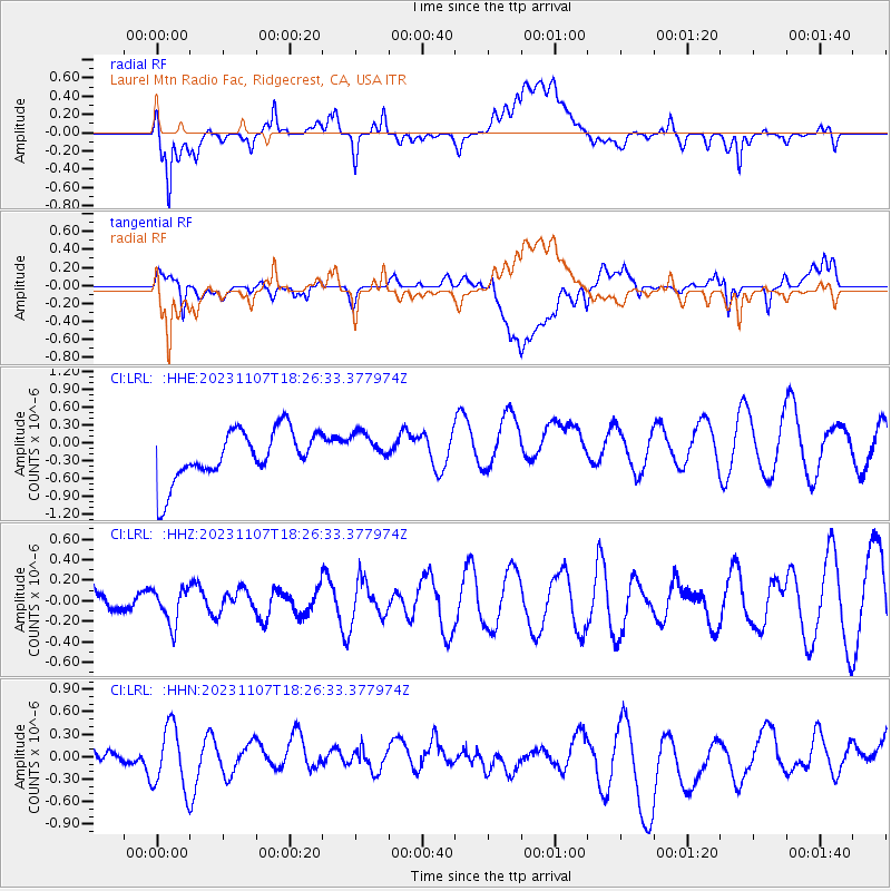
LRL Laurel Mtn Radio Fac, Ridgecrest, CA, USA - Earthquake Result Viewer
*The percent match for this event was below the threshold and hence no stack was calculated.
| Earthquake location: |
Mariana Islands |
| Earthquake latitude/longitude: |
18.8/145.3 |
| Earthquake time(UTC): |
2023/11/07 (311) 18:15:34 GMT |
| Earthquake Depth: |
623 km |
| Earthquake Magnitude: |
5.6 mww |
| Earthquake Catalog/Contributor: |
NEIC PDE/us |
|
| Network: |
CI Caltech Regional Seismic Network |
| Station: |
LRL Laurel Mtn Radio Fac, Ridgecrest, CA, USA |
| Lat/Lon: |
35.48 N/117.68 W |
| Elevation: |
1340 m |
|
| Distance: |
84.8 deg |
| Az: |
54.426 deg |
| Baz: |
289.236 deg |
| Ray Param: |
$rayparam |
*The percent match for this event was below the threshold and hence was not used in the summary stack. |
|
| Radial Match: |
54.678486 % |
| Radial Bump: |
400 |
| Transverse Match: |
47.305172 % |
| Transverse Bump: |
400 |
| SOD ConfigId: |
31937991 |
| Insert Time: |
2023-11-21 18:24:56.624 +0000 |
| GWidth: |
2.5 |
| Max Bumps: |
400 |
| Tol: |
0.001 |
|
Signal To Noise
| Channel | StoN | STA | LTA |
| CI:LRL: :HHZ:20231107T18:26:33.377974Z | 1.3264343 | 1.7727938E-7 | 1.3365107E-7 |
| CI:LRL: :HHN:20231107T18:26:33.377974Z | 1.1699585 | 4.2548118E-7 | 3.6367206E-7 |
| CI:LRL: :HHE:20231107T18:26:33.377974Z | 0.6711855 | 2.82846E-7 | 4.2141255E-7 |
| Arrivals |
| Ps | |
| PpPs | |
| PsPs/PpSs | |


