You are here: Home > Network List > GS - US Geological Survey Networks Stations List
> Station DEC06 Boomer > Earthquake Result Viewer
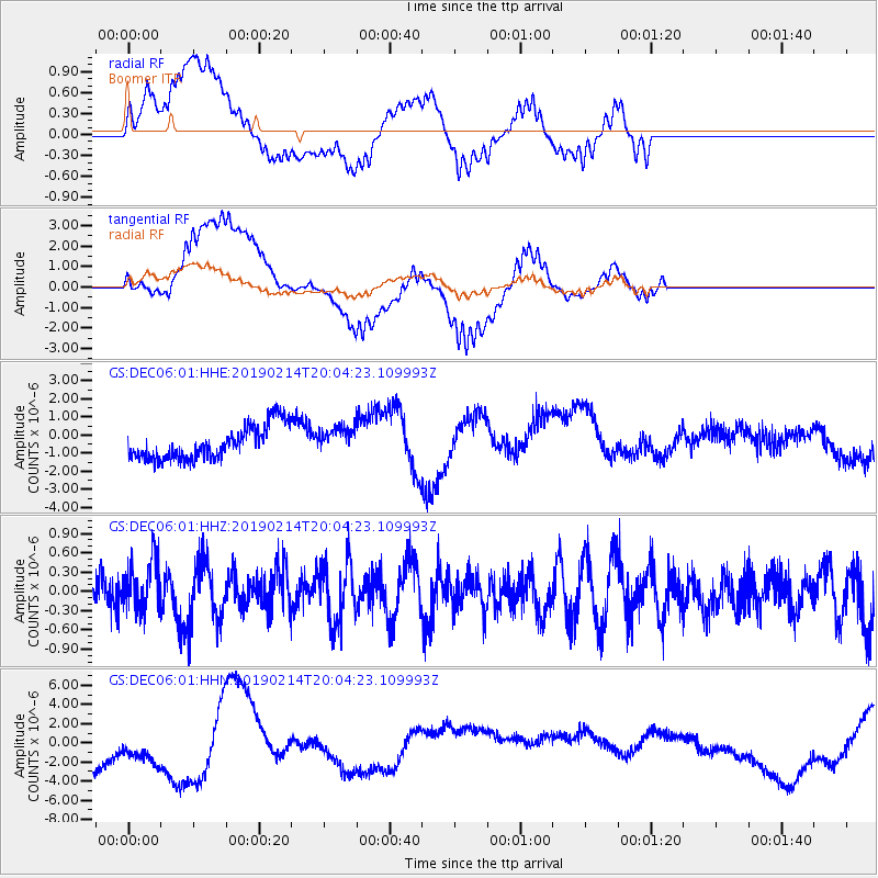
DEC06 Boomer - Earthquake Result Viewer
*The percent match for this event was below the threshold and hence no stack was calculated.
| Earthquake location: |
Northern Mid-Atlantic Ridge |
| Earthquake latitude/longitude: |
35.4/-36.1 |
| Earthquake time(UTC): |
2019/02/14 (045) 19:57:05 GMT |
| Earthquake Depth: |
10 km |
| Earthquake Magnitude: |
6.1 Mww |
| Earthquake Catalog/Contributor: |
NEIC PDE/us |
|
| Network: |
GS US Geological Survey Networks |
| Station: |
DEC06 Boomer |
| Lat/Lon: |
39.90 N/88.95 W |
| Elevation: |
215 m |
|
| Distance: |
41.6 deg |
| Az: |
292.515 deg |
| Baz: |
78.841 deg |
| Ray Param: |
$rayparam |
*The percent match for this event was below the threshold and hence was not used in the summary stack. |
|
| Radial Match: |
45.823795 % |
| Radial Bump: |
400 |
| Transverse Match: |
40.512646 % |
| Transverse Bump: |
400 |
| SOD ConfigId: |
3287751 |
| Insert Time: |
2019-02-28 20:01:34.121 +0000 |
| GWidth: |
2.5 |
| Max Bumps: |
400 |
| Tol: |
0.001 |
|
Signal To Noise
| Channel | StoN | STA | LTA |
| GS:DEC06:01:HHZ:20190214T20:04:23.109993Z | 1.4633396 | 4.0388647E-7 | 2.7600325E-7 |
| GS:DEC06:01:HHN:20190214T20:04:23.109993Z | 1.2482536 | 2.752915E-6 | 2.205413E-6 |
| GS:DEC06:01:HHE:20190214T20:04:23.109993Z | 0.8196565 | 7.463193E-7 | 9.105269E-7 |
| Arrivals |
| Ps | |
| PpPs | |
| PsPs/PpSs | |


