You are here: Home > Network List > TA - USArray Transportable Network (new EarthScope stations) Stations List
> Station E29A Napoleon, ND, USA > Earthquake Result Viewer
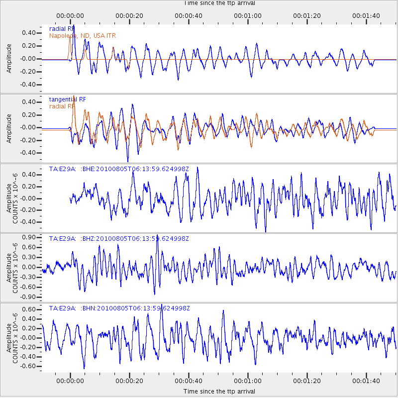
E29A Napoleon, ND, USA - Earthquake Result Viewer
*The percent match for this event was below the threshold and hence no stack was calculated.
| Earthquake location: |
Near Coast Of Central Chile |
| Earthquake latitude/longitude: |
-37.4/-73.3 |
| Earthquake time(UTC): |
2010/08/05 (217) 06:01:47 GMT |
| Earthquake Depth: |
18 km |
| Earthquake Magnitude: |
5.5 MS, 5.4 MB, 5.9 MW, 5.8 MW |
| Earthquake Catalog/Contributor: |
WHDF/NEIC |
|
| Network: |
TA USArray Transportable Network (new EarthScope stations) |
| Station: |
E29A Napoleon, ND, USA |
| Lat/Lon: |
46.57 N/99.64 W |
| Elevation: |
628 m |
|
| Distance: |
86.9 deg |
| Az: |
342.134 deg |
| Baz: |
159.273 deg |
| Ray Param: |
$rayparam |
*The percent match for this event was below the threshold and hence was not used in the summary stack. |
|
| Radial Match: |
54.87188 % |
| Radial Bump: |
400 |
| Transverse Match: |
60.69099 % |
| Transverse Bump: |
400 |
| SOD ConfigId: |
319893 |
| Insert Time: |
2011-01-05 18:01:47.638 +0000 |
| GWidth: |
2.5 |
| Max Bumps: |
400 |
| Tol: |
0.001 |
|
Signal To Noise
| Channel | StoN | STA | LTA |
| TA:E29A: :BHZ:20100805T06:13:59.624998Z | 3.1158779 | 3.0504015E-7 | 9.789862E-8 |
| TA:E29A: :BHN:20100805T06:13:59.624998Z | 1.7472103 | 2.5496573E-7 | 1.4592733E-7 |
| TA:E29A: :BHE:20100805T06:13:59.624998Z | 0.83766854 | 1.2614807E-7 | 1.5059426E-7 |
| Arrivals |
| Ps | |
| PpPs | |
| PsPs/PpSs | |


