You are here: Home > Network List > TA - USArray Transportable Network (new EarthScope stations) Stations List
> Station X33A Lawton, OK, USA > Earthquake Result Viewer
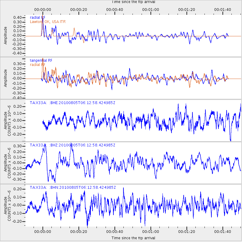
X33A Lawton, OK, USA - Earthquake Result Viewer
*The percent match for this event was below the threshold and hence no stack was calculated.
| Earthquake location: |
Near Coast Of Central Chile |
| Earthquake latitude/longitude: |
-37.4/-73.3 |
| Earthquake time(UTC): |
2010/08/05 (217) 06:01:47 GMT |
| Earthquake Depth: |
18 km |
| Earthquake Magnitude: |
5.5 MS, 5.4 MB, 5.9 MW, 5.8 MW |
| Earthquake Catalog/Contributor: |
WHDF/NEIC |
|
| Network: |
TA USArray Transportable Network (new EarthScope stations) |
| Station: |
X33A Lawton, OK, USA |
| Lat/Lon: |
34.54 N/98.50 W |
| Elevation: |
346 m |
|
| Distance: |
75.4 deg |
| Az: |
338.683 deg |
| Baz: |
159.481 deg |
| Ray Param: |
$rayparam |
*The percent match for this event was below the threshold and hence was not used in the summary stack. |
|
| Radial Match: |
69.79617 % |
| Radial Bump: |
400 |
| Transverse Match: |
71.3221 % |
| Transverse Bump: |
400 |
| SOD ConfigId: |
319893 |
| Insert Time: |
2011-01-05 18:03:49.200 +0000 |
| GWidth: |
2.5 |
| Max Bumps: |
400 |
| Tol: |
0.001 |
|
Signal To Noise
| Channel | StoN | STA | LTA |
| TA:X33A: :BHZ:20100805T06:12:58.424985Z | 3.2339246 | 2.1565052E-7 | 6.668384E-8 |
| TA:X33A: :BHN:20100805T06:12:58.424985Z | 1.4467673 | 8.5450466E-8 | 5.9063037E-8 |
| TA:X33A: :BHE:20100805T06:12:58.424985Z | 0.9184562 | 5.097222E-8 | 5.5497715E-8 |
| Arrivals |
| Ps | |
| PpPs | |
| PsPs/PpSs | |


