You are here: Home > Network List > CI - Caltech Regional Seismic Network Stations List
> Station TIN Tinemaha, Big Pine, CA, USA > Earthquake Result Viewer
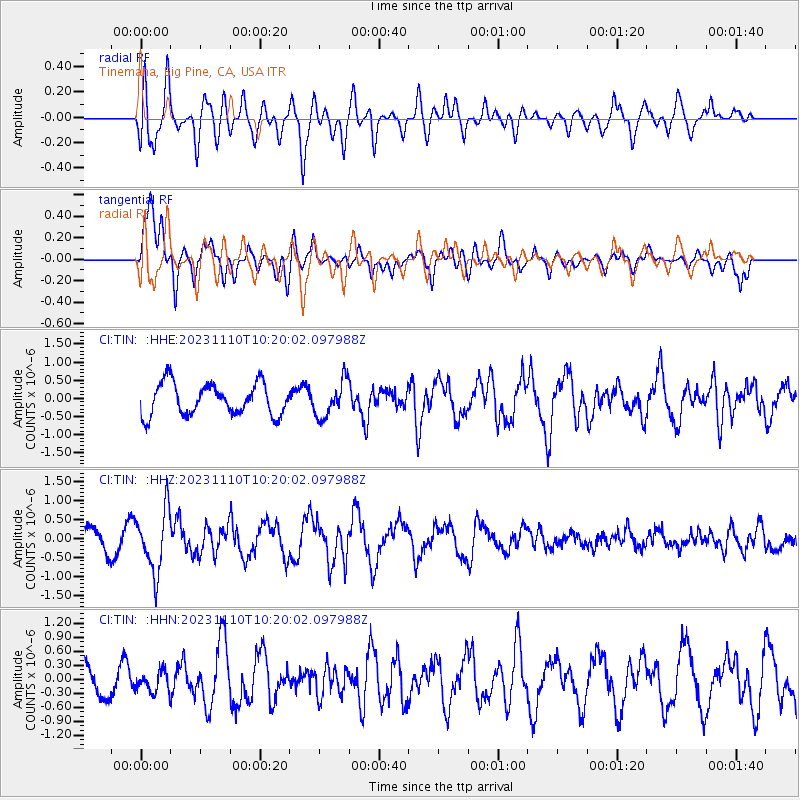
TIN Tinemaha, Big Pine, CA, USA - Earthquake Result Viewer
*The percent match for this event was below the threshold and hence no stack was calculated.
| Earthquake location: |
Kuril Islands |
| Earthquake latitude/longitude: |
45.9/151.0 |
| Earthquake time(UTC): |
2023/11/10 (314) 10:10:04 GMT |
| Earthquake Depth: |
107 km |
| Earthquake Magnitude: |
5.8 mww |
| Earthquake Catalog/Contributor: |
NEIC PDE/us |
|
| Network: |
CI Caltech Regional Seismic Network |
| Station: |
TIN Tinemaha, Big Pine, CA, USA |
| Lat/Lon: |
37.05 N/118.23 W |
| Elevation: |
1197 m |
|
| Distance: |
65.0 deg |
| Az: |
61.928 deg |
| Baz: |
309.632 deg |
| Ray Param: |
$rayparam |
*The percent match for this event was below the threshold and hence was not used in the summary stack. |
|
| Radial Match: |
79.70772 % |
| Radial Bump: |
400 |
| Transverse Match: |
79.26956 % |
| Transverse Bump: |
400 |
| SOD ConfigId: |
31937991 |
| Insert Time: |
2023-11-24 10:21:12.817 +0000 |
| GWidth: |
2.5 |
| Max Bumps: |
400 |
| Tol: |
0.001 |
|
Signal To Noise
| Channel | StoN | STA | LTA |
| CI:TIN: :HHZ:20231110T10:20:02.097988Z | 2.3164995 | 8.171781E-7 | 3.527642E-7 |
| CI:TIN: :HHN:20231110T10:20:02.097988Z | 0.5251012 | 2.178026E-7 | 4.1478214E-7 |
| CI:TIN: :HHE:20231110T10:20:02.097988Z | 1.1476088 | 4.97931E-7 | 4.3388567E-7 |
| Arrivals |
| Ps | |
| PpPs | |
| PsPs/PpSs | |


