You are here: Home > Network List > IU - Global Seismograph Network (GSN - IRIS/USGS) Stations List
> Station PMG Port Moresby, New Guinea > Earthquake Result Viewer
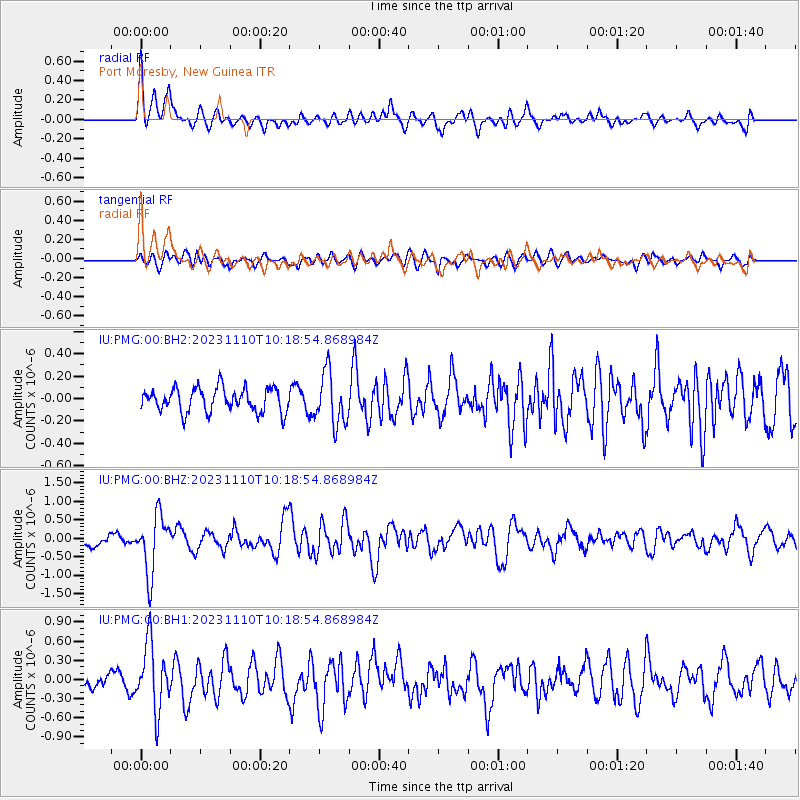
PMG Port Moresby, New Guinea - Earthquake Result Viewer
*The percent match for this event was below the threshold and hence no stack was calculated.
| Earthquake location: |
Kuril Islands |
| Earthquake latitude/longitude: |
45.9/151.0 |
| Earthquake time(UTC): |
2023/11/10 (314) 10:10:04 GMT |
| Earthquake Depth: |
107 km |
| Earthquake Magnitude: |
5.8 mww |
| Earthquake Catalog/Contributor: |
NEIC PDE/us |
|
| Network: |
IU Global Seismograph Network (GSN - IRIS/USGS) |
| Station: |
PMG Port Moresby, New Guinea |
| Lat/Lon: |
9.40 S/147.16 E |
| Elevation: |
90 m |
|
| Distance: |
55.2 deg |
| Az: |
184.622 deg |
| Baz: |
3.269 deg |
| Ray Param: |
$rayparam |
*The percent match for this event was below the threshold and hence was not used in the summary stack. |
|
| Radial Match: |
71.78287 % |
| Radial Bump: |
400 |
| Transverse Match: |
66.02594 % |
| Transverse Bump: |
400 |
| SOD ConfigId: |
31937991 |
| Insert Time: |
2023-11-24 10:27:24.452 +0000 |
| GWidth: |
2.5 |
| Max Bumps: |
400 |
| Tol: |
0.001 |
|
Signal To Noise
| Channel | StoN | STA | LTA |
| IU:PMG:00:BHZ:20231110T10:18:54.868984Z | 5.0485954 | 7.825895E-7 | 1.5501132E-7 |
| IU:PMG:00:BH1:20231110T10:18:54.868984Z | 4.088522 | 5.114276E-7 | 1.2508862E-7 |
| IU:PMG:00:BH2:20231110T10:18:54.868984Z | 2.1839573 | 2.3294632E-7 | 1.0666249E-7 |
| Arrivals |
| Ps | |
| PpPs | |
| PsPs/PpSs | |


