You are here: Home > Network List > TA - USArray Transportable Network (new EarthScope stations) Stations List
> Station G21A Lodge Grass, MT, USA > Earthquake Result Viewer
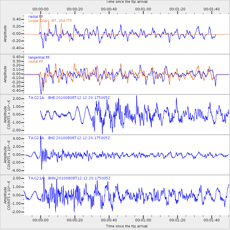
G21A Lodge Grass, MT, USA - Earthquake Result Viewer
*The percent match for this event was below the threshold and hence no stack was calculated.
| Earthquake location: |
Andreanof Islands, Aleutian Is. |
| Earthquake latitude/longitude: |
51.3/-178.6 |
| Earthquake time(UTC): |
2010/08/08 (220) 12:04:28 GMT |
| Earthquake Depth: |
29 km |
| Earthquake Magnitude: |
5.7 MB, 5.0 MS, 5.4 MW, 5.8 ML |
| Earthquake Catalog/Contributor: |
WHDF/NEIC |
|
| Network: |
TA USArray Transportable Network (new EarthScope stations) |
| Station: |
G21A Lodge Grass, MT, USA |
| Lat/Lon: |
45.22 N/107.21 W |
| Elevation: |
1227 m |
|
| Distance: |
46.2 deg |
| Az: |
68.186 deg |
| Baz: |
304.478 deg |
| Ray Param: |
$rayparam |
*The percent match for this event was below the threshold and hence was not used in the summary stack. |
|
| Radial Match: |
63.415077 % |
| Radial Bump: |
400 |
| Transverse Match: |
57.64155 % |
| Transverse Bump: |
400 |
| SOD ConfigId: |
319893 |
| Insert Time: |
2011-01-05 18:36:25.755 +0000 |
| GWidth: |
2.5 |
| Max Bumps: |
400 |
| Tol: |
0.001 |
|
Signal To Noise
| Channel | StoN | STA | LTA |
| TA:G21A: :BHZ:20100808T12:12:20.175005Z | 3.3881142 | 1.4996785E-6 | 4.4262927E-7 |
| TA:G21A: :BHN:20100808T12:12:20.175005Z | 0.93590987 | 6.765783E-7 | 7.229096E-7 |
| TA:G21A: :BHE:20100808T12:12:20.175005Z | 2.1077409 | 9.33378E-7 | 4.4283337E-7 |
| Arrivals |
| Ps | |
| PpPs | |
| PsPs/PpSs | |


