You are here: Home > Network List > UW - Pacific Northwest Regional Seismic Network Stations List
> Station UMAT Pilot Rock, OR, USA > Earthquake Result Viewer
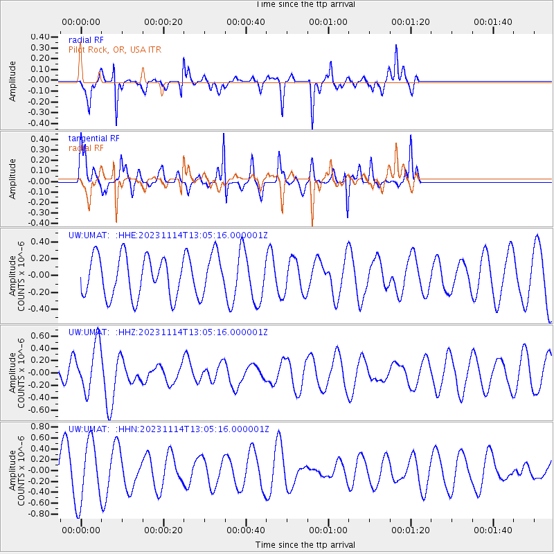
UMAT Pilot Rock, OR, USA - Earthquake Result Viewer
*The percent match for this event was below the threshold and hence no stack was calculated.
| Earthquake location: |
New Britain Region, P.N.G. |
| Earthquake latitude/longitude: |
-6.1/148.2 |
| Earthquake time(UTC): |
2023/11/14 (318) 12:52:25 GMT |
| Earthquake Depth: |
58 km |
| Earthquake Magnitude: |
5.9 mww |
| Earthquake Catalog/Contributor: |
NEIC PDE/us |
|
| Network: |
UW Pacific Northwest Regional Seismic Network |
| Station: |
UMAT Pilot Rock, OR, USA |
| Lat/Lon: |
45.29 N/118.96 W |
| Elevation: |
1318 m |
|
| Distance: |
96.3 deg |
| Az: |
45.175 deg |
| Baz: |
267.753 deg |
| Ray Param: |
$rayparam |
*The percent match for this event was below the threshold and hence was not used in the summary stack. |
|
| Radial Match: |
73.07696 % |
| Radial Bump: |
308 |
| Transverse Match: |
47.0785 % |
| Transverse Bump: |
242 |
| SOD ConfigId: |
31937991 |
| Insert Time: |
2023-11-28 13:08:26.693 +0000 |
| GWidth: |
2.5 |
| Max Bumps: |
400 |
| Tol: |
0.001 |
|
Signal To Noise
| Channel | StoN | STA | LTA |
| UW:UMAT: :HHZ:20231114T13:05:16.000001Z | 2.199632 | 3.956196E-7 | 1.7985718E-7 |
| UW:UMAT: :HHN:20231114T13:05:16.000001Z | 1.5212605 | 5.689384E-7 | 3.7399144E-7 |
| UW:UMAT: :HHE:20231114T13:05:16.000001Z | 1.0562588 | 2.5095179E-7 | 2.3758551E-7 |
| Arrivals |
| Ps | |
| PpPs | |
| PsPs/PpSs | |


