You are here: Home > Network List > CN - Canadian National Seismograph Network Stations List
> Station INK INUVIK, NT > Earthquake Result Viewer
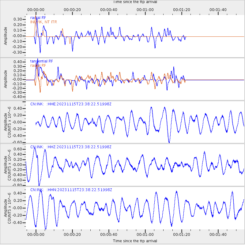
INK INUVIK, NT - Earthquake Result Viewer
*The percent match for this event was below the threshold and hence no stack was calculated.
| Earthquake location: |
Minahassa Peninsula, Sulawesi |
| Earthquake latitude/longitude: |
2.0/124.1 |
| Earthquake time(UTC): |
2023/11/15 (319) 23:26:15 GMT |
| Earthquake Depth: |
303 km |
| Earthquake Magnitude: |
5.7 Mww |
| Earthquake Catalog/Contributor: |
NEIC PDE/us |
|
| Network: |
CN Canadian National Seismograph Network |
| Station: |
INK INUVIK, NT |
| Lat/Lon: |
68.31 N/133.53 W |
| Elevation: |
44 m |
|
| Distance: |
92.7 deg |
| Az: |
21.322 deg |
| Baz: |
282.193 deg |
| Ray Param: |
$rayparam |
*The percent match for this event was below the threshold and hence was not used in the summary stack. |
|
| Radial Match: |
76.16708 % |
| Radial Bump: |
400 |
| Transverse Match: |
58.22551 % |
| Transverse Bump: |
355 |
| SOD ConfigId: |
31937991 |
| Insert Time: |
2023-11-29 23:32:31.879 +0000 |
| GWidth: |
2.5 |
| Max Bumps: |
400 |
| Tol: |
0.001 |
|
Signal To Noise
| Channel | StoN | STA | LTA |
| CN:INK: :HHZ:20231115T23:38:22.51998Z | 2.0139039 | 4.9957487E-7 | 2.4806292E-7 |
| CN:INK: :HHN:20231115T23:38:22.51998Z | 0.9350831 | 3.4928587E-7 | 3.735346E-7 |
| CN:INK: :HHE:20231115T23:38:22.51998Z | 0.5725628 | 7.794438E-8 | 1.3613244E-7 |
| Arrivals |
| Ps | |
| PpPs | |
| PsPs/PpSs | |


