You are here: Home > Network List > US - United States National Seismic Network Stations List
> Station EGMT Eagleton, Montana, USA > Earthquake Result Viewer
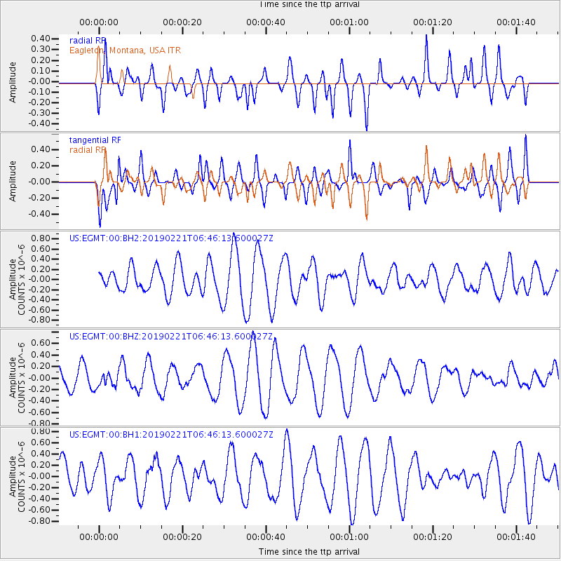
EGMT Eagleton, Montana, USA - Earthquake Result Viewer
*The percent match for this event was below the threshold and hence no stack was calculated.
| Earthquake location: |
Fiji Islands Region |
| Earthquake latitude/longitude: |
-20.9/-178.8 |
| Earthquake time(UTC): |
2019/02/21 (052) 06:34:39 GMT |
| Earthquake Depth: |
617 km |
| Earthquake Magnitude: |
5.6 Mww |
| Earthquake Catalog/Contributor: |
NEIC PDE/us |
|
| Network: |
US United States National Seismic Network |
| Station: |
EGMT Eagleton, Montana, USA |
| Lat/Lon: |
48.02 N/109.75 W |
| Elevation: |
1055 m |
|
| Distance: |
92.2 deg |
| Az: |
38.864 deg |
| Baz: |
240.949 deg |
| Ray Param: |
$rayparam |
*The percent match for this event was below the threshold and hence was not used in the summary stack. |
|
| Radial Match: |
60.672348 % |
| Radial Bump: |
400 |
| Transverse Match: |
64.23773 % |
| Transverse Bump: |
400 |
| SOD ConfigId: |
3313551 |
| Insert Time: |
2019-03-07 06:44:01.445 +0000 |
| GWidth: |
2.5 |
| Max Bumps: |
400 |
| Tol: |
0.001 |
|
Signal To Noise
| Channel | StoN | STA | LTA |
| US:EGMT:00:BHZ:20190221T06:46:13.600027Z | 0.7662974 | 1.1398144E-7 | 1.4874308E-7 |
| US:EGMT:00:BH1:20190221T06:46:13.600027Z | 0.85783976 | 3.119204E-7 | 3.6361146E-7 |
| US:EGMT:00:BH2:20190221T06:46:13.600027Z | 2.3340757 | 5.500354E-7 | 2.3565448E-7 |
| Arrivals |
| Ps | |
| PpPs | |
| PsPs/PpSs | |


