You are here: Home > Network List > CN - Canadian National Seismograph Network Stations List
> Station INK INUVIK, NT > Earthquake Result Viewer
INK INUVIK, NT - Earthquake Result Viewer
*The percent match for this event was below the threshold and hence no stack was calculated.
| Earthquake location: |
Myanmar-China Border Region |
| Earthquake latitude/longitude: |
21.2/99.3 |
| Earthquake time(UTC): |
2023/11/17 (321) 01:37:10 GMT |
| Earthquake Depth: |
10 km |
| Earthquake Magnitude: |
5.7 mww |
| Earthquake Catalog/Contributor: |
NEIC PDE/us |
|
| Network: |
CN Canadian National Seismograph Network |
| Station: |
INK INUVIK, NT |
| Lat/Lon: |
68.31 N/133.53 W |
| Elevation: |
44 m |
|
| Distance: |
82.8 deg |
| Az: |
17.38 deg |
| Baz: |
311.447 deg |
| Ray Param: |
$rayparam |
*The percent match for this event was below the threshold and hence was not used in the summary stack. |
|
| Radial Match: |
63.77983 % |
| Radial Bump: |
400 |
| Transverse Match: |
40.81952 % |
| Transverse Bump: |
319 |
| SOD ConfigId: |
31937991 |
| Insert Time: |
2023-12-01 01:44:17.235 +0000 |
| GWidth: |
2.5 |
| Max Bumps: |
400 |
| Tol: |
0.001 |
|
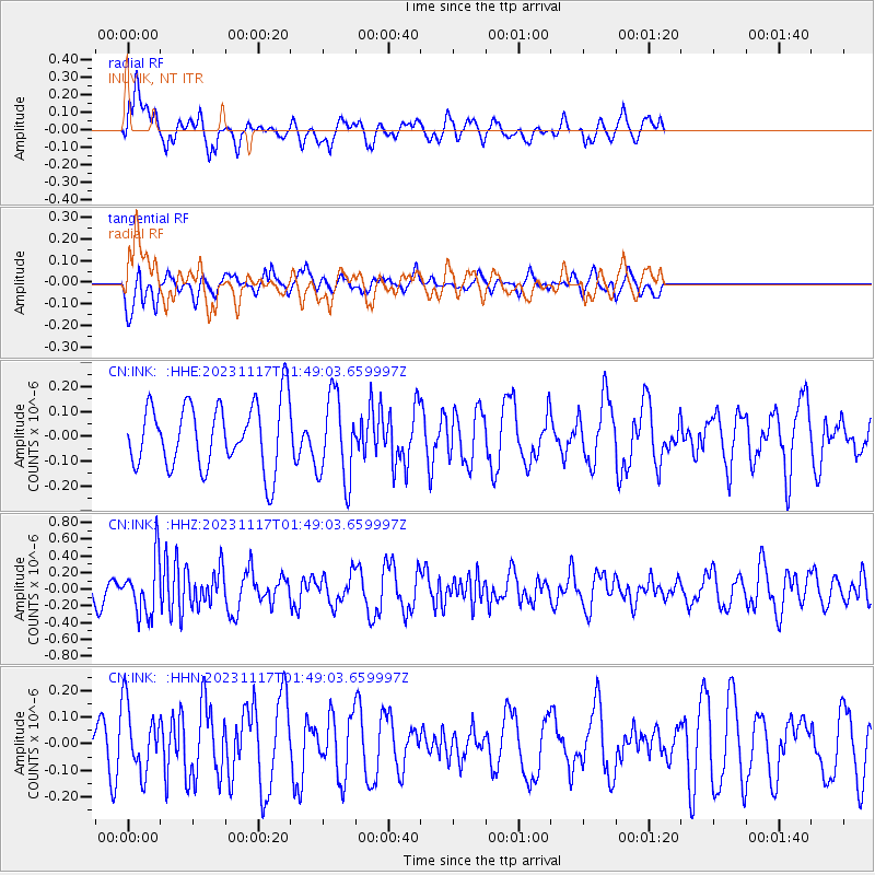
Signal To Noise
| Channel | StoN | STA | LTA |
| CN:INK: :HHZ:20231117T01:49:03.659997Z | 2.5037298 | 3.3080116E-7 | 1.3212335E-7 |
| CN:INK: :HHN:20231117T01:49:03.659997Z | 1.3139069 | 1.2743524E-7 | 9.698955E-8 |
| CN:INK: :HHE:20231117T01:49:03.659997Z | 1.3306142 | 1.7296071E-7 | 1.2998562E-7 |
| Arrivals |
| Ps | |
| PpPs | |
| PsPs/PpSs | |


