You are here: Home > Network List > AV - Alaska Volcano Observatory Stations List
> Station AMKA Regional Station, Amchitka Island, Alaska > Earthquake Result Viewer
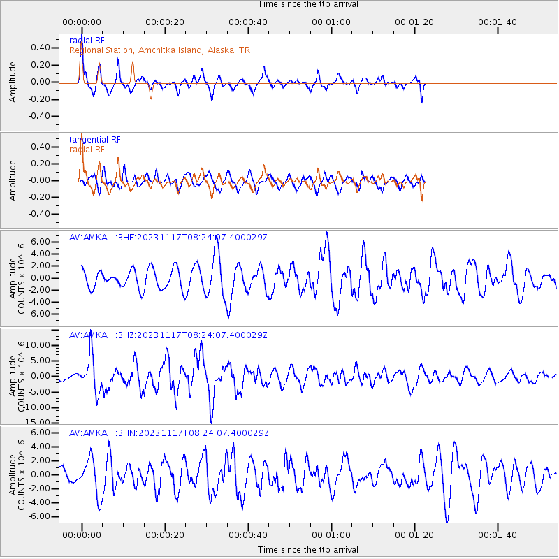
AMKA Regional Station, Amchitka Island, Alaska - Earthquake Result Viewer
*The percent match for this event was below the threshold and hence no stack was calculated.
| Earthquake location: |
Mindanao, Philippines |
| Earthquake latitude/longitude: |
5.6/125.0 |
| Earthquake time(UTC): |
2023/11/17 (321) 08:14:11 GMT |
| Earthquake Depth: |
64 km |
| Earthquake Magnitude: |
6.7 Mww |
| Earthquake Catalog/Contributor: |
NEIC PDE/us |
|
| Network: |
AV Alaska Volcano Observatory |
| Station: |
AMKA Regional Station, Amchitka Island, Alaska |
| Lat/Lon: |
51.38 N/179.30 E |
| Elevation: |
116 m |
|
| Distance: |
63.9 deg |
| Az: |
34.505 deg |
| Baz: |
244.109 deg |
| Ray Param: |
$rayparam |
*The percent match for this event was below the threshold and hence was not used in the summary stack. |
|
| Radial Match: |
78.240295 % |
| Radial Bump: |
369 |
| Transverse Match: |
48.461857 % |
| Transverse Bump: |
340 |
| SOD ConfigId: |
31937991 |
| Insert Time: |
2023-12-01 08:21:16.166 +0000 |
| GWidth: |
2.5 |
| Max Bumps: |
400 |
| Tol: |
0.001 |
|
Signal To Noise
| Channel | StoN | STA | LTA |
| AV:AMKA: :BHZ:20231117T08:24:07.400029Z | 5.3950095 | 5.7645752E-6 | 1.0685013E-6 |
| AV:AMKA: :BHN:20231117T08:24:07.400029Z | 2.2739935 | 2.6533005E-6 | 1.1668021E-6 |
| AV:AMKA: :BHE:20231117T08:24:07.400029Z | 2.3612673 | 3.6828387E-6 | 1.5596873E-6 |
| Arrivals |
| Ps | |
| PpPs | |
| PsPs/PpSs | |


