
535A Dale, TX, USA - Earthquake Result Viewer
| ||||||||||||||||||
| ||||||||||||||||||
| ||||||||||||||||||
|
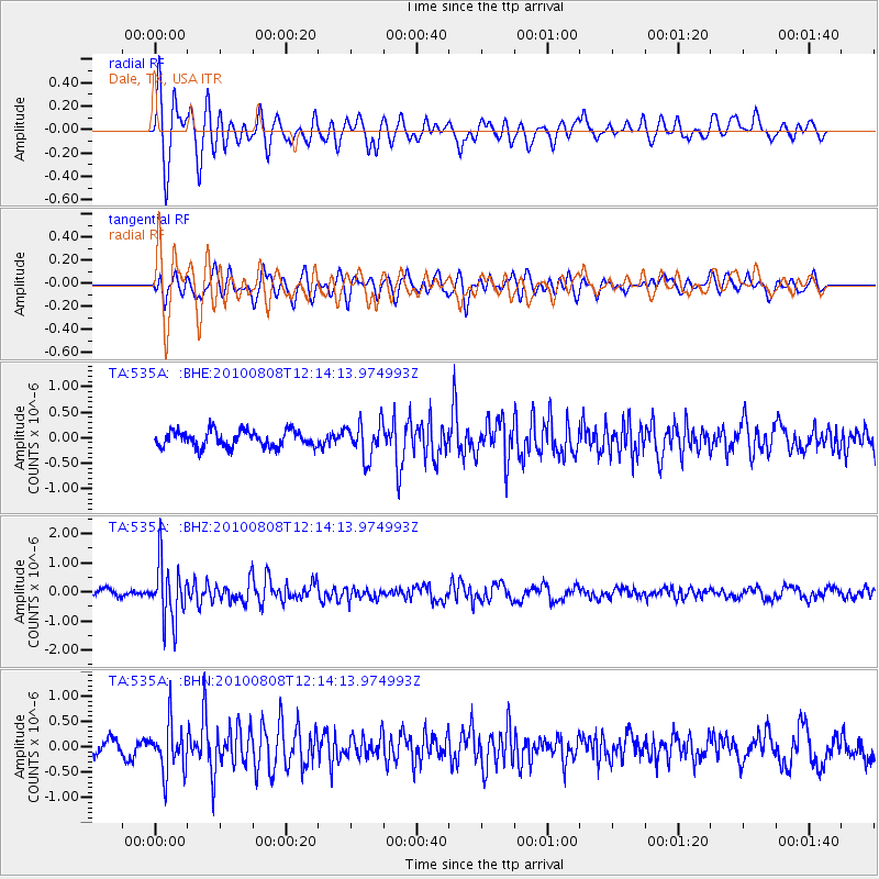
Signal To Noise
| Channel | StoN | STA | LTA |
| TA:535A: :BHZ:20100808T12:14:13.974993Z | 9.255577 | 9.913822E-7 | 1.07111866E-7 |
| TA:535A: :BHN:20100808T12:14:13.974993Z | 3.5460596 | 4.912667E-7 | 1.3853877E-7 |
| TA:535A: :BHE:20100808T12:14:13.974993Z | 2.2025 | 3.4466376E-7 | 1.5648752E-7 |
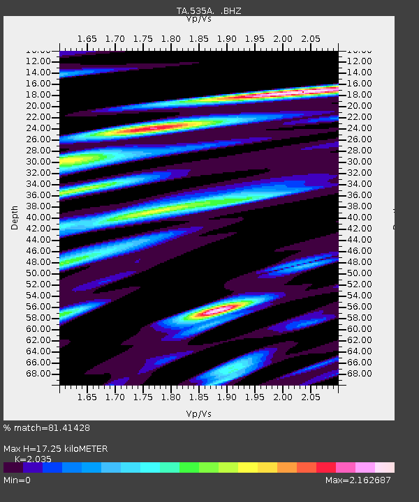
| Arrivals | |
| Ps | 2.9 SECOND |
| PpPs | 7.9 SECOND |
| PsPs/PpSs | 11 SECOND |

