You are here: Home > Network List > GM - US Geological Survey Networks Stations List
> Station IWM01 Jericho 2M Well Monitoring Station > Earthquake Result Viewer
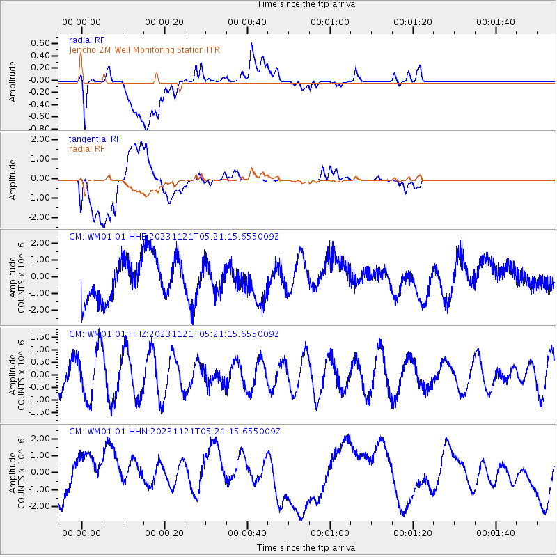
IWM01 Jericho 2M Well Monitoring Station - Earthquake Result Viewer
*The percent match for this event was below the threshold and hence no stack was calculated.
| Earthquake location: |
Central Mid-Atlantic Ridge |
| Earthquake latitude/longitude: |
1.0/-29.0 |
| Earthquake time(UTC): |
2023/11/21 (325) 05:10:26 GMT |
| Earthquake Depth: |
10 km |
| Earthquake Magnitude: |
5.5 Mww |
| Earthquake Catalog/Contributor: |
NEIC PDE/us |
|
| Network: |
GM US Geological Survey Networks |
| Station: |
IWM01 Jericho 2M Well Monitoring Station |
| Lat/Lon: |
36.73 N/96.53 W |
| Elevation: |
328 m |
|
| Distance: |
71.5 deg |
| Az: |
308.489 deg |
| Baz: |
103.064 deg |
| Ray Param: |
$rayparam |
*The percent match for this event was below the threshold and hence was not used in the summary stack. |
|
| Radial Match: |
62.51817 % |
| Radial Bump: |
400 |
| Transverse Match: |
48.893486 % |
| Transverse Bump: |
400 |
| SOD ConfigId: |
31937991 |
| Insert Time: |
2023-12-05 05:22:36.887 +0000 |
| GWidth: |
2.5 |
| Max Bumps: |
400 |
| Tol: |
0.001 |
|
Signal To Noise
| Channel | StoN | STA | LTA |
| GM:IWM01:01:HHZ:20231121T05:21:15.655009Z | 1.2977711 | 9.940529E-7 | 7.659694E-7 |
| GM:IWM01:01:HHN:20231121T05:21:15.655009Z | 0.81885034 | 2.2846123E-6 | 2.7900242E-6 |
| GM:IWM01:01:HHE:20231121T05:21:15.655009Z | 0.6309177 | 7.8834273E-7 | 1.2495174E-6 |
| Arrivals |
| Ps | |
| PpPs | |
| PsPs/PpSs | |


