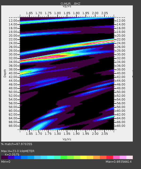
MUR Murrieta - Earthquake Result Viewer

Earthquake location: Vanuatu Islands
Earthquake latitude/longitude: -17.5/168.1
Earthquake time(UTC): 2010/08/10 (222) 05:23:44 GMT
Earthquake Depth: 25 km
Earthquake Magnitude: 6.4 MB, 7.3 MS, 7.3 MW, 7.2 MW
Earthquake Catalog/Contributor: WHDF/NEIC
Network: CI Caltech Regional Seismic Network
Station: MUR Murrieta
Lat/Lon: 33.60 N/117.20 W
Elevation: 562 m
Distance: 87.4 deg
Az: 53.706 deg
Baz: 247.123 deg
Ray Param: 0.04329763
Estimated Moho Depth: 23.0 km
Estimated Crust Vp/Vs: 2.06
Assumed Crust Vp: 6.264 km/s
Estimated Crust Vs: 3.044 km/s
Estimated Crust Poisson's Ratio: 0.35
Radial Match: 97.978355 %
Radial Bump: 273
Transverse Match: 92.000084 %
Transverse Bump: 400
SOD ConfigId: 319893
Insert Time: 2011-01-05 19:22:14.069 +0000
GWidth: 2.5
Max Bumps: 400
Tol: 0.001

Signal To Noise

ChannelStoNSTALTA
CI:MUR: :BHZ:20100810T05:35:58.71999Z37.4935573.166324E-68.4449816E-8
CI:MUR: :BHN:20100810T05:35:58.71999Z8.5234113.7674795E-74.420155E-8
CI:MUR: :BHE:20100810T05:35:58.71999Z14.7144051.0142948E-66.893209E-8
Arrivals
Ps4.0 SECOND
PpPs11 SECOND
PsPs/PpSs15 SECOND