You are here: Home > Network List > US - United States National Seismic Network Stations List
> Station MNTX Cornudas Mountains, Texas, USA > Earthquake Result Viewer
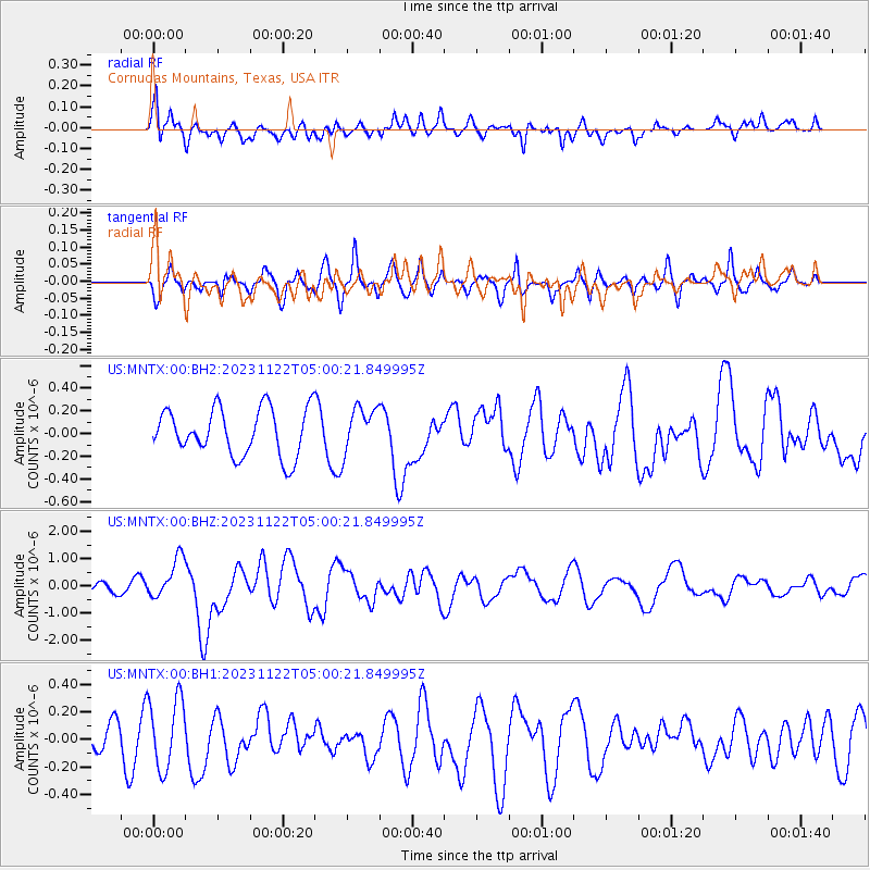
MNTX Cornudas Mountains, Texas, USA - Earthquake Result Viewer
*The percent match for this event was below the threshold and hence no stack was calculated.
| Earthquake location: |
Vanuatu Islands |
| Earthquake latitude/longitude: |
-15.0/168.0 |
| Earthquake time(UTC): |
2023/11/22 (326) 04:47:31 GMT |
| Earthquake Depth: |
13 km |
| Earthquake Magnitude: |
6.7 mww |
| Earthquake Catalog/Contributor: |
NEIC PDE/us |
|
| Network: |
US United States National Seismic Network |
| Station: |
MNTX Cornudas Mountains, Texas, USA |
| Lat/Lon: |
31.70 N/105.38 W |
| Elevation: |
405 m |
|
| Distance: |
94.9 deg |
| Az: |
58.662 deg |
| Baz: |
255.552 deg |
| Ray Param: |
$rayparam |
*The percent match for this event was below the threshold and hence was not used in the summary stack. |
|
| Radial Match: |
51.705624 % |
| Radial Bump: |
400 |
| Transverse Match: |
37.519024 % |
| Transverse Bump: |
400 |
| SOD ConfigId: |
33182351 |
| Insert Time: |
2023-12-06 05:12:50.002 +0000 |
| GWidth: |
2.5 |
| Max Bumps: |
400 |
| Tol: |
0.001 |
|
Signal To Noise
| Channel | StoN | STA | LTA |
| US:MNTX:00:BHZ:20231122T05:00:21.849995Z | 5.1649213 | 7.390095E-7 | 1.4308243E-7 |
| US:MNTX:00:BH1:20231122T05:00:21.849995Z | 2.3958142 | 2.553388E-7 | 1.0657705E-7 |
| US:MNTX:00:BH2:20231122T05:00:21.849995Z | 0.9714302 | 2.0194841E-7 | 2.0788771E-7 |
| Arrivals |
| Ps | |
| PpPs | |
| PsPs/PpSs | |


