You are here: Home > Network List > CN - Canadian National Seismograph Network Stations List
> Station INK INUVIK, NT > Earthquake Result Viewer
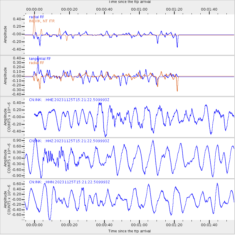
INK INUVIK, NT - Earthquake Result Viewer
*The percent match for this event was below the threshold and hence no stack was calculated.
| Earthquake location: |
Mariana Islands |
| Earthquake latitude/longitude: |
20.1/145.6 |
| Earthquake time(UTC): |
2023/11/25 (329) 15:10:53 GMT |
| Earthquake Depth: |
10 km |
| Earthquake Magnitude: |
5.5 Mww |
| Earthquake Catalog/Contributor: |
NEIC PDE/us |
|
| Network: |
CN Canadian National Seismograph Network |
| Station: |
INK INUVIK, NT |
| Lat/Lon: |
68.31 N/133.53 W |
| Elevation: |
44 m |
|
| Distance: |
68.1 deg |
| Az: |
23.303 deg |
| Baz: |
269.322 deg |
| Ray Param: |
$rayparam |
*The percent match for this event was below the threshold and hence was not used in the summary stack. |
|
| Radial Match: |
65.710724 % |
| Radial Bump: |
400 |
| Transverse Match: |
65.13817 % |
| Transverse Bump: |
400 |
| SOD ConfigId: |
33182351 |
| Insert Time: |
2023-12-09 15:20:47.339 +0000 |
| GWidth: |
2.5 |
| Max Bumps: |
400 |
| Tol: |
0.001 |
|
Signal To Noise
| Channel | StoN | STA | LTA |
| CN:INK: :HHZ:20231125T15:21:22.509993Z | 3.3685508 | 6.7933445E-7 | 2.0166964E-7 |
| CN:INK: :HHN:20231125T15:21:22.509993Z | 1.3691387 | 2.7986331E-7 | 2.044083E-7 |
| CN:INK: :HHE:20231125T15:21:22.509993Z | 1.007739 | 1.7320139E-7 | 1.7187128E-7 |
| Arrivals |
| Ps | |
| PpPs | |
| PsPs/PpSs | |


