You are here: Home > Network List > US - United States National Seismic Network Stations List
> Station SCIA State Center, Iowa, USA > Earthquake Result Viewer
SCIA State Center, Iowa, USA - Earthquake Result Viewer

| Earthquake location: |
Peru-Ecuador Border Region |
| Earthquake latitude/longitude: |
-2.2/-77.0 |
| Earthquake time(UTC): |
2019/02/22 (053) 10:17:22 GMT |
| Earthquake Depth: |
132 km |
| Earthquake Magnitude: |
7.5 mww |
| Earthquake Catalog/Contributor: |
NEIC PDE/us |
|
| Network: |
US United States National Seismic Network |
| Station: |
SCIA State Center, Iowa, USA |
| Lat/Lon: |
41.91 N/93.22 W |
| Elevation: |
312 m |
|
| Distance: |
46.3 deg |
| Az: |
343.265 deg |
| Baz: |
157.327 deg |
| Ray Param: |
0.070265375 |
| Estimated Moho Depth: |
38.5 km |
| Estimated Crust Vp/Vs: |
1.94 |
| Assumed Crust Vp: |
6.498 km/s |
| Estimated Crust Vs: |
3.349 km/s |
| Estimated Crust Poisson's Ratio: |
0.32 |
|
| Radial Match: |
98.807846 % |
| Radial Bump: |
307 |
| Transverse Match: |
93.39653 % |
| Transverse Bump: |
400 |
| SOD ConfigId: |
3313551 |
| Insert Time: |
2019-03-08 10:28:25.164 +0000 |
| GWidth: |
2.5 |
| Max Bumps: |
400 |
| Tol: |
0.001 |
|
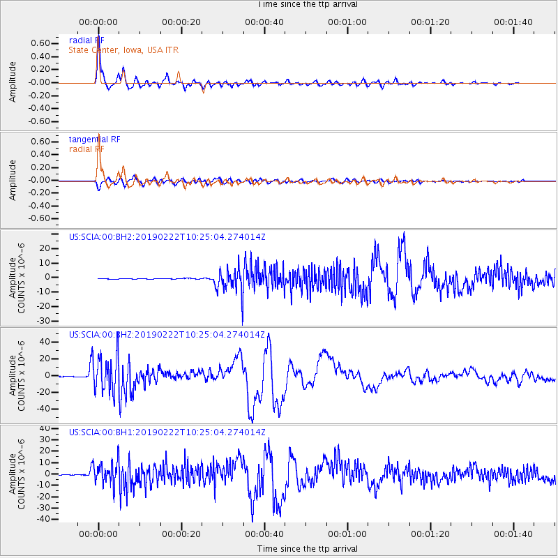
Signal To Noise
| Channel | StoN | STA | LTA |
| US:SCIA:00:BHZ:20190222T10:25:04.274014Z | 59.143616 | 2.218796E-5 | 3.7515392E-7 |
| US:SCIA:00:BH1:20190222T10:25:04.274014Z | 39.987812 | 9.759312E-6 | 2.4405716E-7 |
| US:SCIA:00:BH2:20190222T10:25:04.274014Z | 36.100487 | 8.513783E-6 | 2.3583569E-7 |
| Arrivals |
| Ps | 5.9 SECOND |
| PpPs | 16 SECOND |
| PsPs/PpSs | 22 SECOND |


