You are here: Home > Network List > US - United States National Seismic Network Stations List
> Station DUG Dugway, Tooele County, Utah, USA > Earthquake Result Viewer
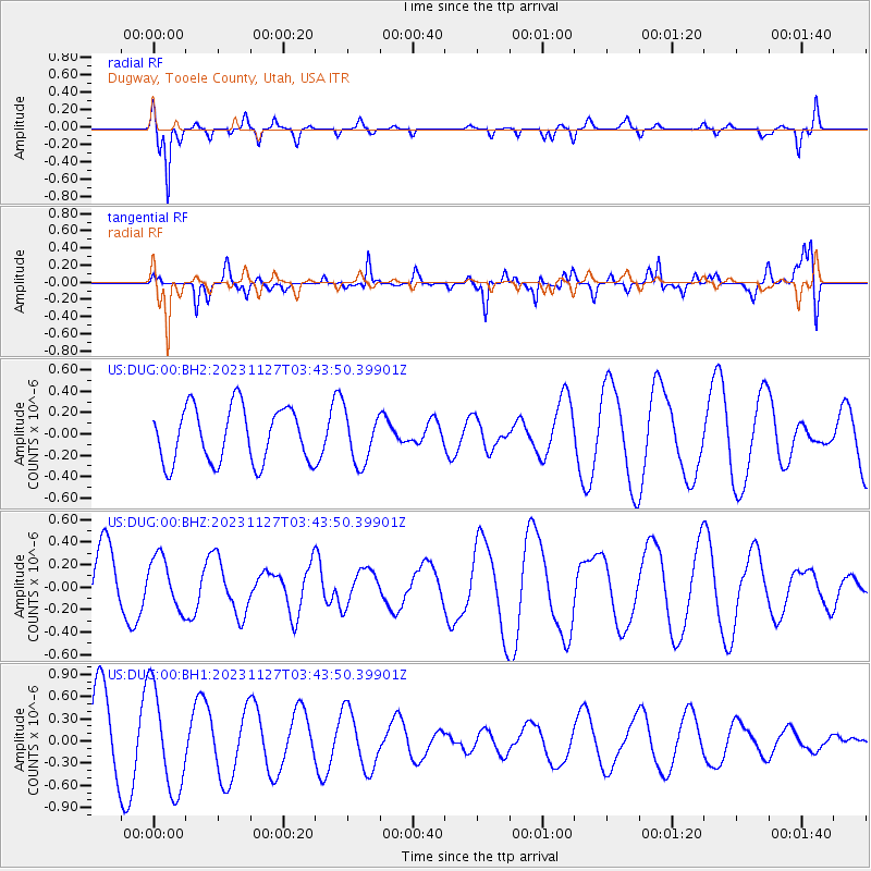
DUG Dugway, Tooele County, Utah, USA - Earthquake Result Viewer
*The percent match for this event was below the threshold and hence no stack was calculated.
| Earthquake location: |
Vanuatu Islands Region |
| Earthquake latitude/longitude: |
-21.0/173.9 |
| Earthquake time(UTC): |
2023/11/27 (331) 03:31:16 GMT |
| Earthquake Depth: |
10 km |
| Earthquake Magnitude: |
5.5 Mww |
| Earthquake Catalog/Contributor: |
NEIC PDE/us |
|
| Network: |
US United States National Seismic Network |
| Station: |
DUG Dugway, Tooele County, Utah, USA |
| Lat/Lon: |
40.19 N/112.81 W |
| Elevation: |
1477 m |
|
| Distance: |
91.3 deg |
| Az: |
47.208 deg |
| Baz: |
243.508 deg |
| Ray Param: |
$rayparam |
*The percent match for this event was below the threshold and hence was not used in the summary stack. |
|
| Radial Match: |
75.36232 % |
| Radial Bump: |
390 |
| Transverse Match: |
50.830307 % |
| Transverse Bump: |
400 |
| SOD ConfigId: |
33182351 |
| Insert Time: |
2023-12-11 03:50:18.514 +0000 |
| GWidth: |
2.5 |
| Max Bumps: |
400 |
| Tol: |
0.001 |
|
Signal To Noise
| Channel | StoN | STA | LTA |
| US:DUG:00:BHZ:20231127T03:43:50.39901Z | 1.0140843 | 2.2791868E-7 | 2.2475318E-7 |
| US:DUG:00:BH1:20231127T03:43:50.39901Z | 1.6820751 | 6.888986E-7 | 4.0955277E-7 |
| US:DUG:00:BH2:20231127T03:43:50.39901Z | 0.9293916 | 2.3949246E-7 | 2.5768736E-7 |
| Arrivals |
| Ps | |
| PpPs | |
| PsPs/PpSs | |


