You are here: Home > Network List > US - United States National Seismic Network Stations List
> Station AMTX Amarillo, Texas, USA > Earthquake Result Viewer
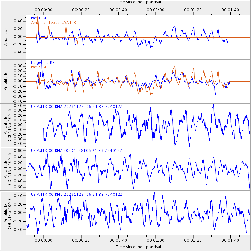
AMTX Amarillo, Texas, USA - Earthquake Result Viewer
*The percent match for this event was below the threshold and hence no stack was calculated.
| Earthquake location: |
Fox Islands, Aleutian Islands |
| Earthquake latitude/longitude: |
52.7/-167.1 |
| Earthquake time(UTC): |
2023/11/28 (332) 06:13:22 GMT |
| Earthquake Depth: |
26 km |
| Earthquake Magnitude: |
5.6 Mww |
| Earthquake Catalog/Contributor: |
NEIC PDE/us |
|
| Network: |
US United States National Seismic Network |
| Station: |
AMTX Amarillo, Texas, USA |
| Lat/Lon: |
34.53 N/101.41 W |
| Elevation: |
1010 m |
|
| Distance: |
49.1 deg |
| Az: |
84.437 deg |
| Baz: |
312.858 deg |
| Ray Param: |
$rayparam |
*The percent match for this event was below the threshold and hence was not used in the summary stack. |
|
| Radial Match: |
47.18795 % |
| Radial Bump: |
400 |
| Transverse Match: |
59.4752 % |
| Transverse Bump: |
400 |
| SOD ConfigId: |
33182351 |
| Insert Time: |
2023-12-12 06:36:42.503 +0000 |
| GWidth: |
2.5 |
| Max Bumps: |
400 |
| Tol: |
0.001 |
|
Signal To Noise
| Channel | StoN | STA | LTA |
| US:AMTX:00:BHZ:20231128T06:21:33.724012Z | 1.8961006 | 3.2221718E-7 | 1.6993674E-7 |
| US:AMTX:00:BH1:20231128T06:21:33.724012Z | 1.062569 | 1.9718937E-7 | 1.8557793E-7 |
| US:AMTX:00:BH2:20231128T06:21:33.724012Z | 0.81091434 | 1.2786978E-7 | 1.5768593E-7 |
| Arrivals |
| Ps | |
| PpPs | |
| PsPs/PpSs | |


