You are here: Home > Network List > US - United States National Seismic Network Stations List
> Station EGMT Eagleton, Montana, USA > Earthquake Result Viewer
EGMT Eagleton, Montana, USA - Earthquake Result Viewer
*The percent match for this event was below the threshold and hence no stack was calculated.
| Earthquake location: |
Windward Islands |
| Earthquake latitude/longitude: |
12.6/-59.8 |
| Earthquake time(UTC): |
2023/11/28 (332) 15:26:12 GMT |
| Earthquake Depth: |
39 km |
| Earthquake Magnitude: |
5.1 Mww |
| Earthquake Catalog/Contributor: |
NEIC PDE/us |
|
| Network: |
US United States National Seismic Network |
| Station: |
EGMT Eagleton, Montana, USA |
| Lat/Lon: |
48.02 N/109.75 W |
| Elevation: |
1055 m |
|
| Distance: |
54.4 deg |
| Az: |
320.766 deg |
| Baz: |
113.13 deg |
| Ray Param: |
$rayparam |
*The percent match for this event was below the threshold and hence was not used in the summary stack. |
|
| Radial Match: |
56.925415 % |
| Radial Bump: |
400 |
| Transverse Match: |
54.517815 % |
| Transverse Bump: |
400 |
| SOD ConfigId: |
33182351 |
| Insert Time: |
2023-12-12 15:49:31.302 +0000 |
| GWidth: |
2.5 |
| Max Bumps: |
400 |
| Tol: |
0.001 |
|
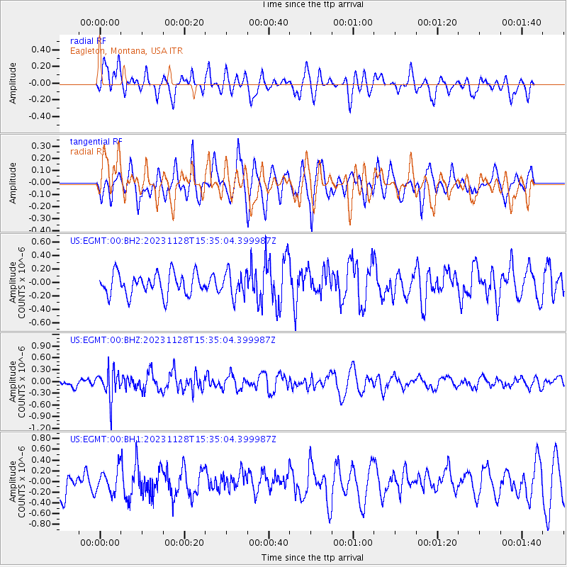
Signal To Noise
| Channel | StoN | STA | LTA |
| US:EGMT:00:BHZ:20231128T15:35:04.399987Z | 1.9725305 | 3.543661E-7 | 1.796505E-7 |
| US:EGMT:00:BH1:20231128T15:35:04.399987Z | 0.85215753 | 2.1602061E-7 | 2.5349846E-7 |
| US:EGMT:00:BH2:20231128T15:35:04.399987Z | 1.1545943 | 1.8803654E-7 | 1.6285941E-7 |
| Arrivals |
| Ps | |
| PpPs | |
| PsPs/PpSs | |


