You are here: Home > Network List > US - United States National Seismic Network Stations List
> Station HAWA Hanford, Washington, USA > Earthquake Result Viewer
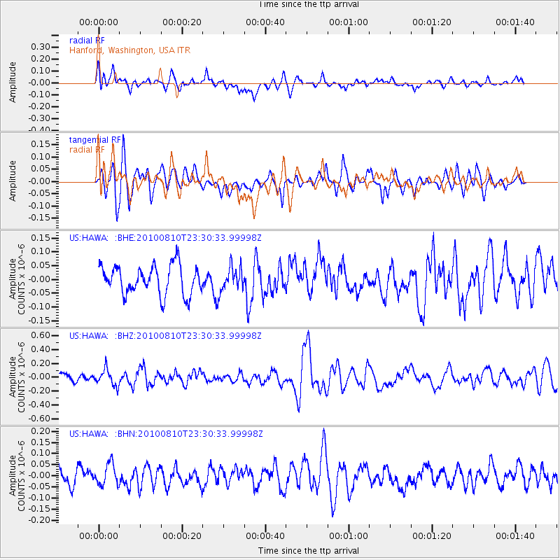
HAWA Hanford, Washington, USA - Earthquake Result Viewer
*The percent match for this event was below the threshold and hence no stack was calculated.
| Earthquake location: |
Vanuatu Islands |
| Earthquake latitude/longitude: |
-14.5/167.3 |
| Earthquake time(UTC): |
2010/08/10 (222) 23:18:31 GMT |
| Earthquake Depth: |
192 km |
| Earthquake Magnitude: |
5.9 MW, 5.4 MB, 5.9 MW |
| Earthquake Catalog/Contributor: |
WHDF/NEIC |
|
| Network: |
US United States National Seismic Network |
| Station: |
HAWA Hanford, Washington, USA |
| Lat/Lon: |
46.39 N/119.53 W |
| Elevation: |
364 m |
|
| Distance: |
89.1 deg |
| Az: |
41.484 deg |
| Baz: |
247.989 deg |
| Ray Param: |
$rayparam |
*The percent match for this event was below the threshold and hence was not used in the summary stack. |
|
| Radial Match: |
49.302883 % |
| Radial Bump: |
400 |
| Transverse Match: |
60.349693 % |
| Transverse Bump: |
400 |
| SOD ConfigId: |
319893 |
| Insert Time: |
2011-01-05 19:54:16.745 +0000 |
| GWidth: |
2.5 |
| Max Bumps: |
400 |
| Tol: |
0.001 |
|
Signal To Noise
| Channel | StoN | STA | LTA |
| US:HAWA: :BHZ:20100810T23:30:33.99998Z | 1.6620994 | 1.1879488E-7 | 7.147279E-8 |
| US:HAWA: :BHN:20100810T23:30:33.99998Z | 1.0740763 | 4.945989E-8 | 4.6048765E-8 |
| US:HAWA: :BHE:20100810T23:30:33.99998Z | 0.77025545 | 4.0354884E-8 | 5.239156E-8 |
| Arrivals |
| Ps | |
| PpPs | |
| PsPs/PpSs | |


