You are here: Home > Network List > US - United States National Seismic Network Stations List
> Station DGMT Dagmar, Montana, USA > Earthquake Result Viewer
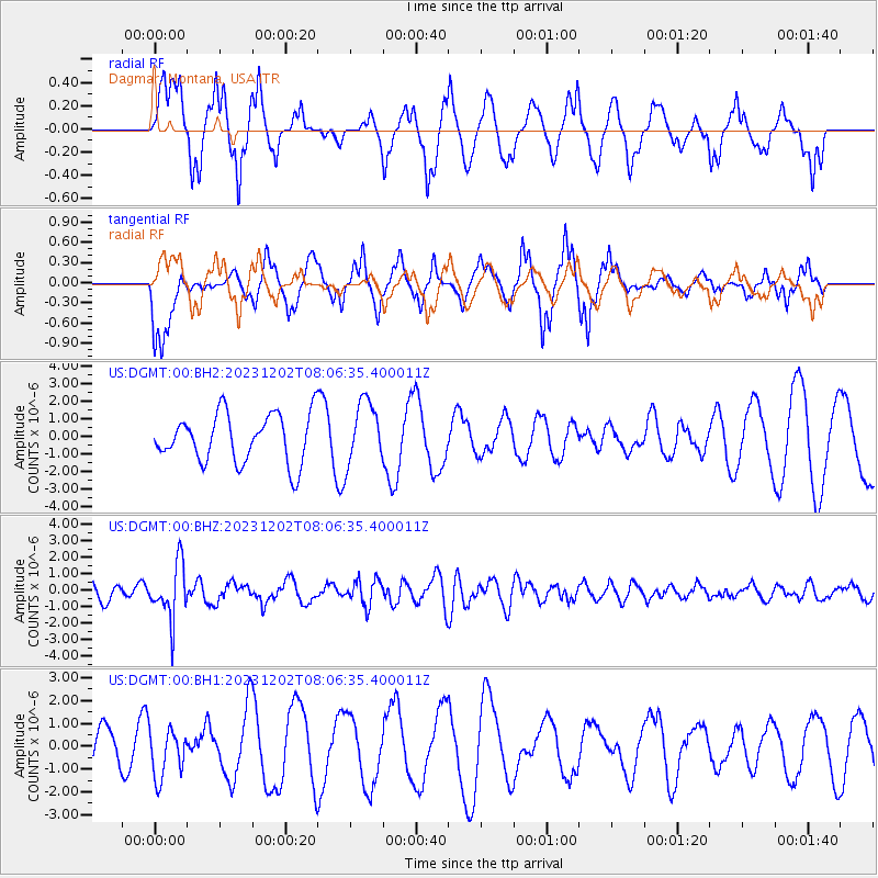
DGMT Dagmar, Montana, USA - Earthquake Result Viewer
*The percent match for this event was below the threshold and hence no stack was calculated.
| Earthquake location: |
Northern Chile |
| Earthquake latitude/longitude: |
-19.2/-69.1 |
| Earthquake time(UTC): |
2023/12/02 (336) 07:55:40 GMT |
| Earthquake Depth: |
106 km |
| Earthquake Magnitude: |
5.8 Mww |
| Earthquake Catalog/Contributor: |
NEIC PDE/us |
|
| Network: |
US United States National Seismic Network |
| Station: |
DGMT Dagmar, Montana, USA |
| Lat/Lon: |
48.47 N/104.20 W |
| Elevation: |
646 m |
|
| Distance: |
74.3 deg |
| Az: |
336.578 deg |
| Baz: |
145.635 deg |
| Ray Param: |
$rayparam |
*The percent match for this event was below the threshold and hence was not used in the summary stack. |
|
| Radial Match: |
72.709755 % |
| Radial Bump: |
397 |
| Transverse Match: |
71.35243 % |
| Transverse Bump: |
362 |
| SOD ConfigId: |
33232451 |
| Insert Time: |
2023-12-16 08:24:58.414 +0000 |
| GWidth: |
2.5 |
| Max Bumps: |
400 |
| Tol: |
0.001 |
|
Signal To Noise
| Channel | StoN | STA | LTA |
| US:DGMT:00:BHZ:20231202T08:06:35.400011Z | 3.7064364 | 1.6399307E-6 | 4.4245482E-7 |
| US:DGMT:00:BH1:20231202T08:06:35.400011Z | 0.7534302 | 1.0764641E-6 | 1.4287509E-6 |
| US:DGMT:00:BH2:20231202T08:06:35.400011Z | 1.3093933 | 1.7972595E-6 | 1.3725896E-6 |
| Arrivals |
| Ps | |
| PpPs | |
| PsPs/PpSs | |


