You are here: Home > Network List > UW - Pacific Northwest Regional Seismic Network Stations List
> Station LEBA Lebam, WA, USA > Earthquake Result Viewer
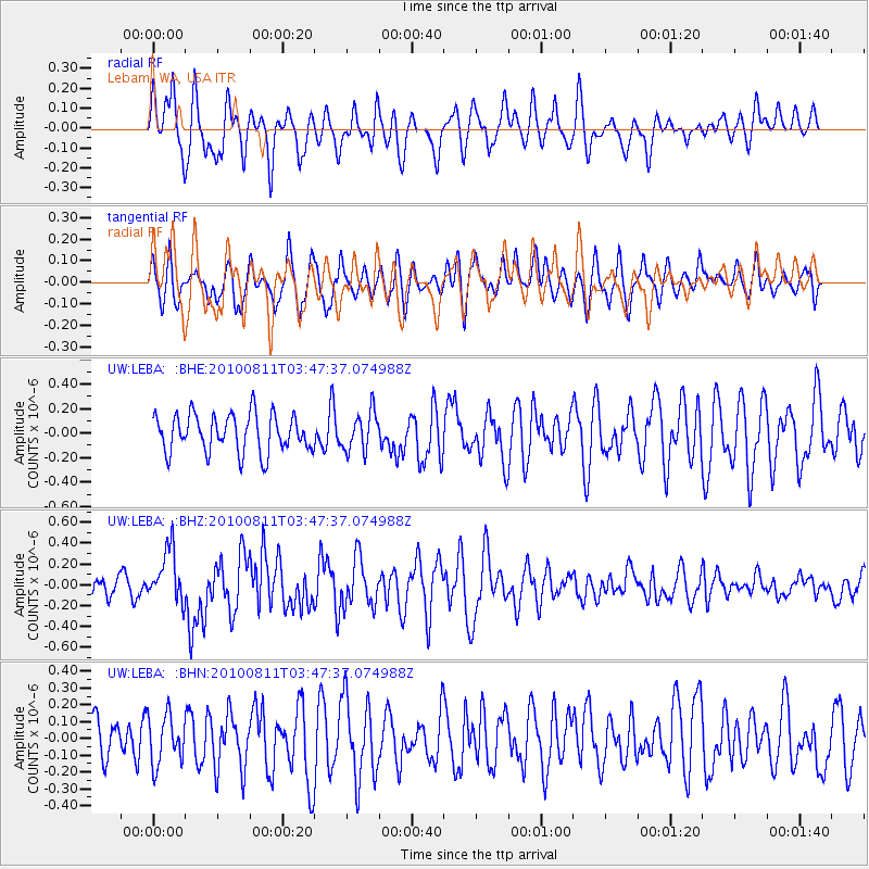
LEBA Lebam, WA, USA - Earthquake Result Viewer
*The percent match for this event was below the threshold and hence no stack was calculated.
| Earthquake location: |
Vanuatu Islands |
| Earthquake latitude/longitude: |
-17.4/167.8 |
| Earthquake time(UTC): |
2010/08/11 (223) 03:35:19 GMT |
| Earthquake Depth: |
35 km |
| Earthquake Magnitude: |
5.6 MB, 5.7 MS, 5.8 MW |
| Earthquake Catalog/Contributor: |
WHDF/NEIC |
|
| Network: |
UW Pacific Northwest Regional Seismic Network |
| Station: |
LEBA Lebam, WA, USA |
| Lat/Lon: |
46.55 N/123.56 W |
| Elevation: |
73 m |
|
| Distance: |
88.6 deg |
| Az: |
40.01 deg |
| Baz: |
242.796 deg |
| Ray Param: |
$rayparam |
*The percent match for this event was below the threshold and hence was not used in the summary stack. |
|
| Radial Match: |
71.712845 % |
| Radial Bump: |
400 |
| Transverse Match: |
50.561153 % |
| Transverse Bump: |
400 |
| SOD ConfigId: |
319893 |
| Insert Time: |
2011-01-05 20:08:45.774 +0000 |
| GWidth: |
2.5 |
| Max Bumps: |
400 |
| Tol: |
0.001 |
|
Signal To Noise
| Channel | StoN | STA | LTA |
| UW:LEBA: :BHZ:20100811T03:47:37.074988Z | 2.6492229 | 2.5405382E-7 | 9.589749E-8 |
| UW:LEBA: :BHN:20100811T03:47:37.074988Z | 1.1918325 | 1.4683327E-7 | 1.2319958E-7 |
| UW:LEBA: :BHE:20100811T03:47:37.074988Z | 1.0159457 | 1.5643928E-7 | 1.5398392E-7 |
| Arrivals |
| Ps | |
| PpPs | |
| PsPs/PpSs | |


