You are here: Home > Network List > CI - Caltech Regional Seismic Network Stations List
> Station GMR Granite Mountains Research Center > Earthquake Result Viewer
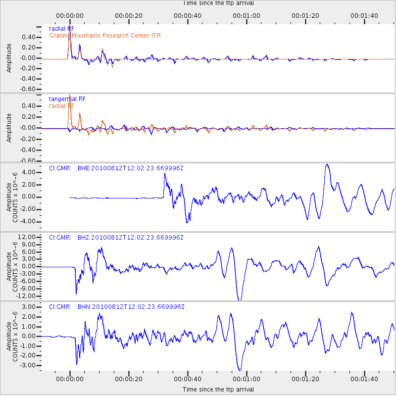
GMR Granite Mountains Research Center - Earthquake Result Viewer

| Earthquake location: |
Ecuador |
| Earthquake latitude/longitude: |
-1.3/-77.3 |
| Earthquake time(UTC): |
2010/08/12 (224) 11:54:15 GMT |
| Earthquake Depth: |
207 km |
| Earthquake Magnitude: |
6.4 MB, 7.1 MW, 7.1 MW |
| Earthquake Catalog/Contributor: |
WHDF/NEIC |
|
| Network: |
CI Caltech Regional Seismic Network |
| Station: |
GMR Granite Mountains Research Center |
| Lat/Lon: |
34.78 N/115.66 W |
| Elevation: |
1326 m |
|
| Distance: |
50.7 deg |
| Az: |
318.728 deg |
| Baz: |
126.753 deg |
| Ray Param: |
0.06711332 |
| Estimated Moho Depth: |
26.75 km |
| Estimated Crust Vp/Vs: |
1.77 |
| Assumed Crust Vp: |
6.276 km/s |
| Estimated Crust Vs: |
3.541 km/s |
| Estimated Crust Poisson's Ratio: |
0.27 |
|
| Radial Match: |
97.7788 % |
| Radial Bump: |
264 |
| Transverse Match: |
90.9866 % |
| Transverse Bump: |
400 |
| SOD ConfigId: |
319893 |
| Insert Time: |
2011-01-05 20:21:17.073 +0000 |
| GWidth: |
2.5 |
| Max Bumps: |
400 |
| Tol: |
0.001 |
|
Signal To Noise
| Channel | StoN | STA | LTA |
| CI:GMR: :BHZ:20100812T12:02:23.669996Z | 63.531513 | 3.7688937E-6 | 5.932322E-8 |
| CI:GMR: :BHN:20100812T12:02:23.669996Z | 27.01813 | 1.0733326E-6 | 3.972638E-8 |
| CI:GMR: :BHE:20100812T12:02:23.669996Z | 52.510136 | 1.5948564E-6 | 3.037235E-8 |
| Arrivals |
| Ps | 3.5 SECOND |
| PpPs | 11 SECOND |
| PsPs/PpSs | 15 SECOND |


