You are here: Home > Network List > GS - US Geological Survey Networks Stations List
> Station KAN10 Keim Farm > Earthquake Result Viewer
KAN10 Keim Farm - Earthquake Result Viewer
*The percent match for this event was below the threshold and hence no stack was calculated.
| Earthquake location: |
Central Peru |
| Earthquake latitude/longitude: |
-14.7/-70.1 |
| Earthquake time(UTC): |
2019/03/01 (060) 08:50:41 GMT |
| Earthquake Depth: |
257 km |
| Earthquake Magnitude: |
7.0 mww |
| Earthquake Catalog/Contributor: |
NEIC PDE/us |
|
| Network: |
GS US Geological Survey Networks |
| Station: |
KAN10 Keim Farm |
| Lat/Lon: |
37.12 N/98.10 W |
| Elevation: |
417 m |
|
| Distance: |
57.9 deg |
| Az: |
333.729 deg |
| Baz: |
147.594 deg |
| Ray Param: |
$rayparam |
*The percent match for this event was below the threshold and hence was not used in the summary stack. |
|
| Radial Match: |
95.87035 % |
| Radial Bump: |
348 |
| Transverse Match: |
96.57907 % |
| Transverse Bump: |
285 |
| SOD ConfigId: |
3313551 |
| Insert Time: |
2019-03-15 09:03:58.800 +0000 |
| GWidth: |
2.5 |
| Max Bumps: |
400 |
| Tol: |
0.001 |
|
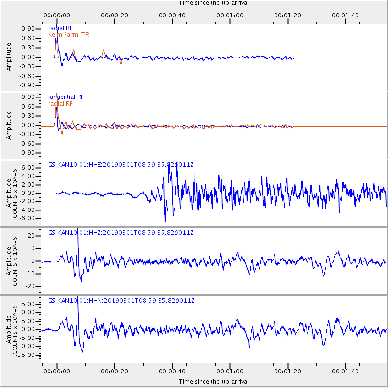
Signal To Noise
| Channel | StoN | STA | LTA |
| GS:KAN10:01:HHZ:20190301T08:59:35.829011Z | 20.818514 | 3.5945784E-6 | 1.7266258E-7 |
| GS:KAN10:01:HHN:20190301T08:59:35.829011Z | 14.2302685 | 3.2732721E-6 | 2.300218E-7 |
| GS:KAN10:01:HHE:20190301T08:59:35.829011Z | 4.356565 | 9.494657E-7 | 2.1793905E-7 |
| Arrivals |
| Ps | |
| PpPs | |
| PsPs/PpSs | |


