You are here: Home > Network List > IU - Global Seismograph Network (GSN - IRIS/USGS) Stations List
> Station RSSD Black Hills, South Dakota, USA > Earthquake Result Viewer
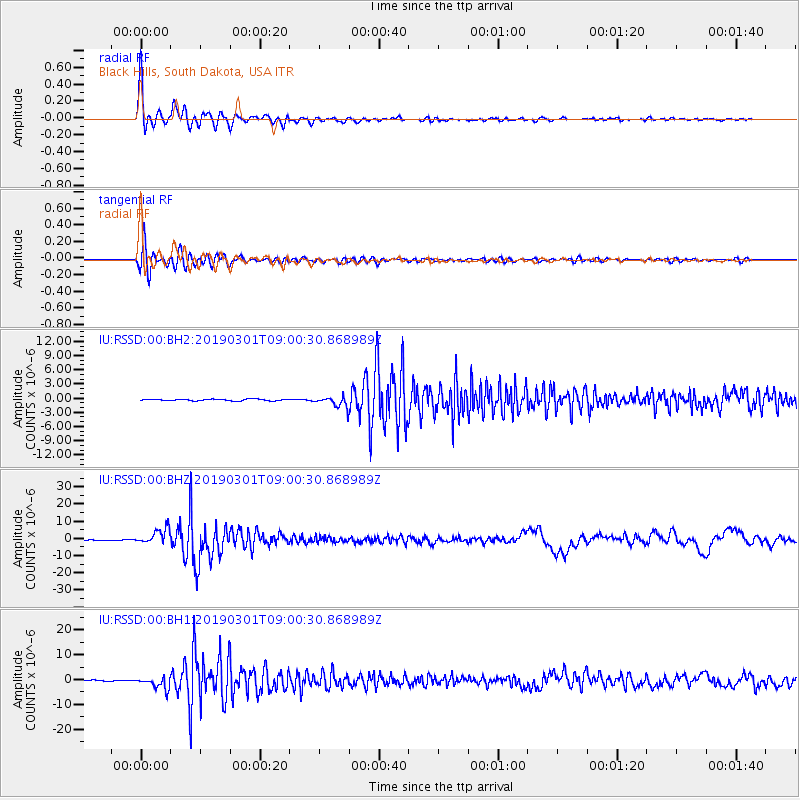
RSSD Black Hills, South Dakota, USA - Earthquake Result Viewer
*The percent match for this event was below the threshold and hence no stack was calculated.
| Earthquake location: |
Central Peru |
| Earthquake latitude/longitude: |
-14.7/-70.1 |
| Earthquake time(UTC): |
2019/03/01 (060) 08:50:41 GMT |
| Earthquake Depth: |
257 km |
| Earthquake Magnitude: |
7.0 mww |
| Earthquake Catalog/Contributor: |
NEIC PDE/us |
|
| Network: |
IU Global Seismograph Network (GSN - IRIS/USGS) |
| Station: |
RSSD Black Hills, South Dakota, USA |
| Lat/Lon: |
44.12 N/104.04 W |
| Elevation: |
2090 m |
|
| Distance: |
66.2 deg |
| Az: |
333.95 deg |
| Baz: |
143.836 deg |
| Ray Param: |
$rayparam |
*The percent match for this event was below the threshold and hence was not used in the summary stack. |
|
| Radial Match: |
96.462 % |
| Radial Bump: |
400 |
| Transverse Match: |
94.01989 % |
| Transverse Bump: |
400 |
| SOD ConfigId: |
3313551 |
| Insert Time: |
2019-03-15 09:04:46.155 +0000 |
| GWidth: |
2.5 |
| Max Bumps: |
400 |
| Tol: |
0.001 |
|
Signal To Noise
| Channel | StoN | STA | LTA |
| IU:RSSD:00:BHZ:20190301T09:00:30.868989Z | 27.476498 | 4.563127E-6 | 1.6607382E-7 |
| IU:RSSD:00:BH1:20190301T09:00:30.868989Z | 14.039466 | 2.3883767E-6 | 1.7011877E-7 |
| IU:RSSD:00:BH2:20190301T09:00:30.868989Z | 6.348862 | 1.112719E-6 | 1.7526276E-7 |
| Arrivals |
| Ps | |
| PpPs | |
| PsPs/PpSs | |


