You are here: Home > Network List > AV - Alaska Volcano Observatory Stations List
> Station MAPS Pakushin Southeast, Makushin Volcano, Alaska > Earthquake Result Viewer
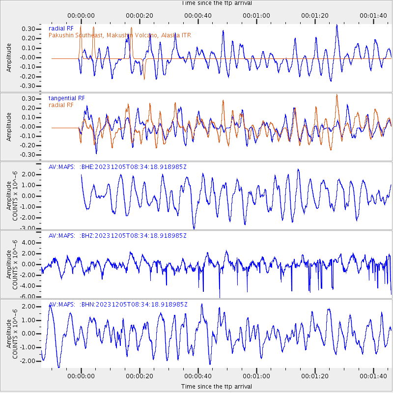
MAPS Pakushin Southeast, Makushin Volcano, Alaska - Earthquake Result Viewer
*The percent match for this event was below the threshold and hence no stack was calculated.
| Earthquake location: |
Mindoro, Philippines |
| Earthquake latitude/longitude: |
13.9/120.5 |
| Earthquake time(UTC): |
2023/12/05 (339) 08:23:55 GMT |
| Earthquake Depth: |
78 km |
| Earthquake Magnitude: |
5.7 Mww |
| Earthquake Catalog/Contributor: |
NEIC PDE/us |
|
| Network: |
AV Alaska Volcano Observatory |
| Station: |
MAPS Pakushin Southeast, Makushin Volcano, Alaska |
| Lat/Lon: |
53.81 N/166.94 W |
| Elevation: |
333 m |
|
| Distance: |
68.6 deg |
| Az: |
37.432 deg |
| Baz: |
264.332 deg |
| Ray Param: |
$rayparam |
*The percent match for this event was below the threshold and hence was not used in the summary stack. |
|
| Radial Match: |
50.169052 % |
| Radial Bump: |
400 |
| Transverse Match: |
51.61786 % |
| Transverse Bump: |
400 |
| SOD ConfigId: |
33232451 |
| Insert Time: |
2023-12-19 08:29:36.160 +0000 |
| GWidth: |
2.5 |
| Max Bumps: |
400 |
| Tol: |
0.001 |
|
Signal To Noise
| Channel | StoN | STA | LTA |
| AV:MAPS: :BHZ:20231205T08:34:18.918985Z | 1.0187769 | 8.678381E-7 | 8.51843E-7 |
| AV:MAPS: :BHN:20231205T08:34:18.918985Z | 1.0704261 | 1.0888673E-6 | 1.0172279E-6 |
| AV:MAPS: :BHE:20231205T08:34:18.918985Z | 0.9875515 | 9.516571E-7 | 9.636531E-7 |
| Arrivals |
| Ps | |
| PpPs | |
| PsPs/PpSs | |


