You are here: Home > Network List > US - United States National Seismic Network Stations List
> Station DUG Dugway, Tooele County, Utah, USA > Earthquake Result Viewer
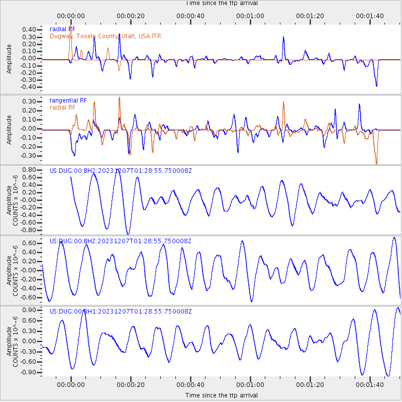
DUG Dugway, Tooele County, Utah, USA - Earthquake Result Viewer
*The percent match for this event was below the threshold and hence no stack was calculated.
| Earthquake location: |
West Chile Rise |
| Earthquake latitude/longitude: |
-34.9/-104.3 |
| Earthquake time(UTC): |
2023/12/07 (341) 01:17:44 GMT |
| Earthquake Depth: |
10 km |
| Earthquake Magnitude: |
5.8 Mww |
| Earthquake Catalog/Contributor: |
NEIC PDE/us |
|
| Network: |
US United States National Seismic Network |
| Station: |
DUG Dugway, Tooele County, Utah, USA |
| Lat/Lon: |
40.19 N/112.81 W |
| Elevation: |
1477 m |
|
| Distance: |
75.2 deg |
| Az: |
353.29 deg |
| Baz: |
172.801 deg |
| Ray Param: |
$rayparam |
*The percent match for this event was below the threshold and hence was not used in the summary stack. |
|
| Radial Match: |
64.87078 % |
| Radial Bump: |
274 |
| Transverse Match: |
45.55106 % |
| Transverse Bump: |
362 |
| SOD ConfigId: |
33232451 |
| Insert Time: |
2023-12-21 01:36:50.873 +0000 |
| GWidth: |
2.5 |
| Max Bumps: |
400 |
| Tol: |
0.001 |
|
Signal To Noise
| Channel | StoN | STA | LTA |
| US:DUG:00:BHZ:20231207T01:28:55.750008Z | 0.9774409 | 3.7270004E-7 | 3.8130187E-7 |
| US:DUG:00:BH1:20231207T01:28:55.750008Z | 3.4444087 | 6.2989847E-7 | 1.8287564E-7 |
| US:DUG:00:BH2:20231207T01:28:55.750008Z | 0.26812747 | 1.3536315E-7 | 5.048463E-7 |
| Arrivals |
| Ps | |
| PpPs | |
| PsPs/PpSs | |


